London Road

London Road

My post focuses on London Road, which was mentioned in The Man with the Twisted Lip. London Road was south of the River Thames, and is really only distinguished on a map for being close to the Norbury Hill Park. Although London Road does not show up on the Charles Booth Online Archive, the area that was close to it was a middle class area, with some pink, indicating that some families were comfortable.

Majority of the crimes, according to the Old Bailey, were thefts, including violent thefts. There were a small amount of murders; the Old Bailey had 29 records of Killings. I felt that this indicated a sense of relative peace in the area. Although there were thefts, people obviously did not really have to worry about their lives being put in immediate danger.

London Road was not a little avenue, and stretched for quite a bit. Therefore it can be said that London Road served as a major transportation road. It’s only mentioned once in The Man With the Twisted Lip. “We both sprang in, and away we dashed down the London Road. A few country carts were stirring, bearing in vegetables to the metropolis, but the lines of villas on either side were as silent and lifeless as some city in a dream”. As seen by the above map, London Road was actually far from the heart of London. With the quote, London Road seems to be a clash of city and country, with produce being brought into the city, and invoking the feel of the city. The country carts keep the country feel alive, and the silence create the perfect balance. This goes back to the theme of duality in The Man With the Twisted Lip. Neville had his dual identity, and so does London Road.

Cannon Street Station

Screen Shot 2015-10-18 at 9.42.34 PM

Cannon Street Station is a real landmark in London and it is near the river Thames and sits quietly near the middle of the area. The people that live in this vicinity are poor as reflected within the light blue symbols that are coordinated on the map. There are various reports within the Old Bailey  of petty, simple, or grand larcenies, along with robberies, reports on murder, and various acts of deception, such as forgery. The railroad track connects to many different roads and streets in the precinct smack in the middle of the neighborhood. Surrounding St. Michaels, St. Mary’s, and St. Magnus, Cannon station street stands as the epicenter for all of the local churches. Seeing as it stands within an impoverish center, it was a high area of violence, robbery, and oppression as it was an area that was dominated by the poor and within that led to an opium den that happened to be located a few blocks over in upper swan dam lane, so the area was also consumed with people funding over control of opium. Although since upper Swandam lane is located near a pier it is relatively blocked off from the richer parts of London.

In Sir Arthur Conan Doyle’s story “Man with the Twisted Lip” it takes place in these areas and references the drug cartel and the huge situational obsession with opium and how it changed the lives of the rich Englishmen that are absorbed within its clutches. Although Cannon Street Station is mentioned only once as a place in which Neville is said to get home via that location, it is referenced as a port that connects the other impoverished parts of the city together and it serves as a beacon that transports people from the rest of London, i.e.., the richer parts or middle class, and connects them to the poor district in which the opium and poorer acts are constantly seen. This is reflected as Neville has a nice family and is relatively well off, so as he goes to the poor section of London to intake in opium in the poorer districts, he hides his richer ego aside as he goes into the den to blend in with the poor.


Upper Swandam Lane

Swan Lane


In Sir Arthur Conan Doyle’s short Sherlock Holmes story, “The Man with the Twisted Lip”, the reader is introduced to the eerie and narrow Upper Swandam Lane based on its realistic counterpart, Swan Lane.

Upper Swamdam Lane, according to Dr. Watson is “a vile alley lurking behind the high wharves which line the north side of the river to the east of London Bridge. Between a slop-shop and a gin-shop, approached by a steep flight of steps leading down to a black gap like the mouth of a cave, I found the den of which I was in search” (Doyle 128). East London, as we have consistently read about, is not a nest that the rich are wont to reside. Depicted on the map above, Swan Lane looks as though it is hidden, making it a back-alley to put the poor of London with only a single entrance from Thames Street. Because of Swan Lane’s location in London, being relatively near the Thames and surrounded by various wharves and piers, the incoming trafficking of opium made Swan Lane a perfect area for Doyle to fictionalize his pivotal plot point of the opium den.

swan poverty pic


From The Charles Booth Online Poverty Archive, Swan Lane, located inside the star on the above image, is light blue in color, indicating the impoverished living in the area. Due to the poor, seemingly closed off street, and its proximity to London Bridge and Cannon Street Station, Doyle’s character Neville St. Clair is able to embody a beggar and use the opium den as a changing room from one facet of life into another. The opium den reeling in the rich to a poverty-stricken area is a perfect place to cross one social class border into another. Especially when the rich are emptying their pockets to quell their opium addictions.

All in all, the historical data from the Booth Online Poverty Archive and the location of Swan Lane bring to life Doyle’s depiction of Upper Swandam Lane, as well as accurately expose a pocketed opium den. Through this, Doyle is able expose corruption of social class and addiction through a narrow port area.

_________________

Works Cited:

Doyle, Arthur Conan. The Man with the Twisted Lip. N.p.: n.p., n.d. Print.

“Booth Poverty Map & Modern Map (Charles Booth Online Archive).” Booth Poverty Map & Modern Map (Charles Booth Online Archive). N.p., n.d. Web. 18 Oct. 2015.

St. Johns Wood Road

St Johns Wood

Screen-Shot-2015-10-18-at-09.48.55-PM.png

St John’s Wood is at the North West end of Regents Park in the area of Westminster. According to the map I obtained from Charles Booth Online Archive, this area is mainly inhabited by the wealthy. There are mainly red and orange markings signifying upper to middle class. I was not surprised to see there was not much crime in this area according to Old Bailey Online. There were only a few thefts and did not report any major crimes. This goes along with more of the upper class neighborhoods in London, however in the poor areas the crime is higher simply due to people trying to survive.

Looking at the map of St. Johns Wood Road there are not many businesses to note. There is a Children’s Hospital and a Women’s Orphanage, but other buildings are not notated on the map leading me to believe they are residences.

carriages-from-St-Johns-rail-crash
St. John’s Station accident

When doing research I found that St. Johns station was opened in 1849, it was a single island platform with just two tracks but it did not have a station house. It normally only serves trains to and from Cannon Street. By 1865 the railway had two more tracks but still did not have a station. During its inception there were many fatalities at this railroad. During the construction a landslip occurred causing 80 tons of debris to come down and bury four of its workers. Two of the men survived, but the other two could not be saved. The accidents that happened once the railroad was in operation was mainly due to fog. In 1898 a fatal accident occurred at St Johns station where the signalman could not see very well, he thought the train had gone and he signaled for the next one to come. The train in fact was still sitting at the platform and the oncoming train collided causing many fatalities. In 1873 The St. Johns Station was finally built was named after a large nearby church. It has since become more stable with not as many fatalities and running smooth.

In Sherlock Holmes story, Irene Adler lives in St. John’s Wood on a fictitious street called Serpentine Avenue. Looking up the word serpentine, it means “of, characteristic of, or resembling a serpent, as in form or movement.” I can say she is representative of a snake in both form and movement. She moves around quite slyly and does so, often unnoticed. She had the smarts enough to outwit not only her ex the King of Bohemia but the infamous Sherlock Holmes. She followed him home dressed as a man to see if it was indeed him. She was told if the king were to employ anyone it would be Sherlock Holmes to find this picture. Once she realized it was him she replaced the desired photo with one of herself. She keeps this photo of her and the king to have the upper hand if he wants to try and torture her any more than he has.


http://www.londonreconnections.com/2013/accidents-and-islands-a-history-of-st-johns-station-part-1/

http://dictionary.reference.com/browse/serpentine

http://www.oldbaileyonline.org/static/London-life19th.jsp


The Langham Hotel

Screen Shot 2015-10-18 at 7.55.29 PM

According to the Langham hotel website, “Delighting guests with gracious hospitality since 1865.” The Langham hotel was originally designed in the year of 1858, but unfortunately the plans to begin building the hotel failed. It wasn’t until the year of 1863 where the foundation for the hotel was created by two architects named Giles and Murray. The hotel “was opened in June, 1865, with a luncheon at which the Prince of Wales was present;” This hotel has been one of the most luxurious hotels in London with its spacious rooms and tall ceilings. The hotel is “It measures upwards of 200 feet in the facade looking up Portland Place, and is upwards of 120 feet in height, the rooms rising to a sixth storey, and overtops by some forty or fifty feet all the mansions in Portland Place and Cavendish Square” making it one of the biggest buildings of that area.

Screen Shot 2015-10-18 at 8.00.29 PM

The hotels architecture was very simple and can be described as italian style. Although the hotel looked very simple, it attracted many people of class and money, which is evident in Sherlock Holme’s A Scandal in Bohemia. This hotel is mentioned during the meet up between Holme’s and The King. The King was using this hotel as a form of hiding out with Miss adler, where he was checked in under the name “Count Von Kramm.” The King, a man of high class and power, was expected nothing less than to stay at the richest and highest hotel, even if he was doing scandalous things. To this day, this hotel continues its reputation by providing those staying with good, high quality  services.


Walford, Edward. ‘Oxford Street and its northern tributaries: Part 2 of 2.’ Old and New London: Volume 4. London: Cassell, Petter & Galpin, 1878. 441-467. British History Online. Web. 13 October 2015. http://www.british-history.ac.uk/old-new-london/vol4/pp441-467.

“Hotel Overview | London Luxury Hotel | The Langham, London.” Hotel Overview | London Luxury Hotel | The Langham, London. N.p., n.d. Web. 18 Oct. 2015.


Edgware road


Edgware oad

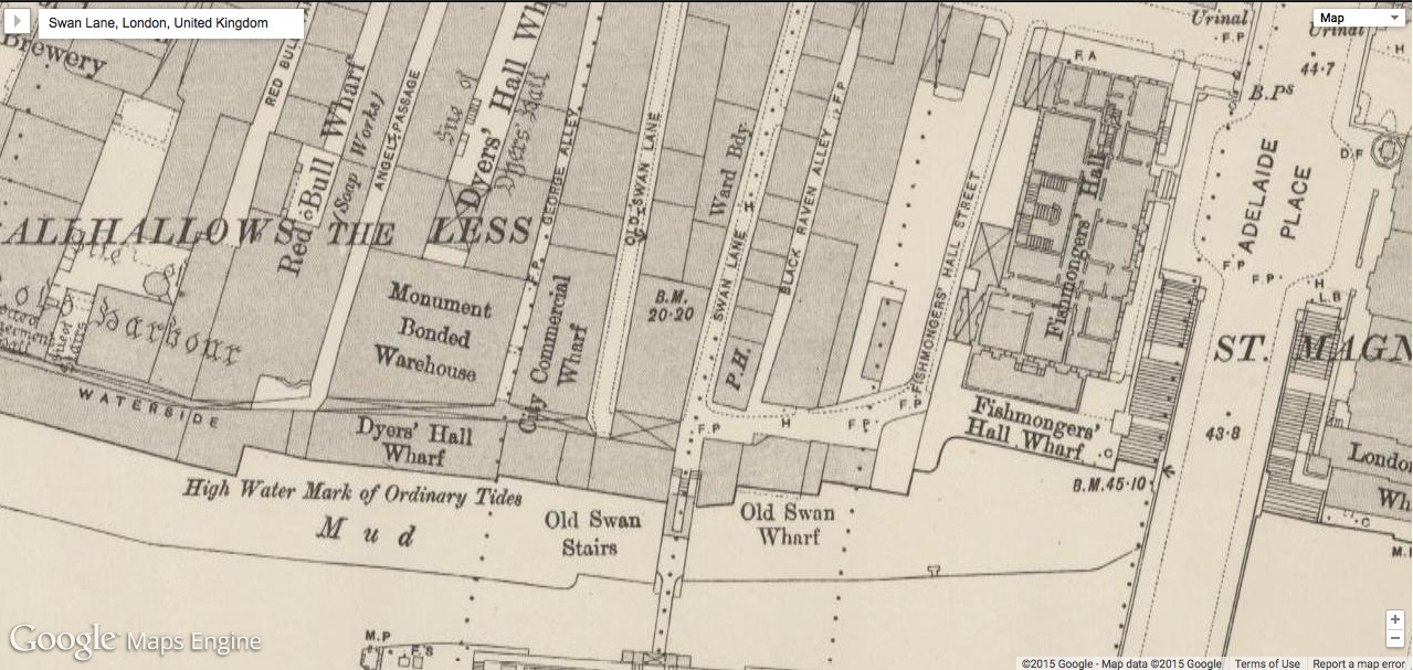
Edgware Road, London, is the location of the illusory St. Monica’s Church in a short story entitled “Adventures of Sherlock Holmes: Scandal in Bohemia” (“Scandal in Bohemia”, 8).  Written by Sir Arthur Conan Doyle, Holmes is best known for his keen capacity to think logically, his perceptive ability to use forensic science, and his astute aptitude to alter his persona and then swiftly adapt to any disguise. And, true to his character’s persona, while dressed as a drunken out of work groom Holmes finds himself being haphazardly pulled into St. Monica’s Church a fictional church, to bear witness in the marriage of retired American opera singer Irene Adler and the handsome London lawyer Godfrey Norton.

Booth Online

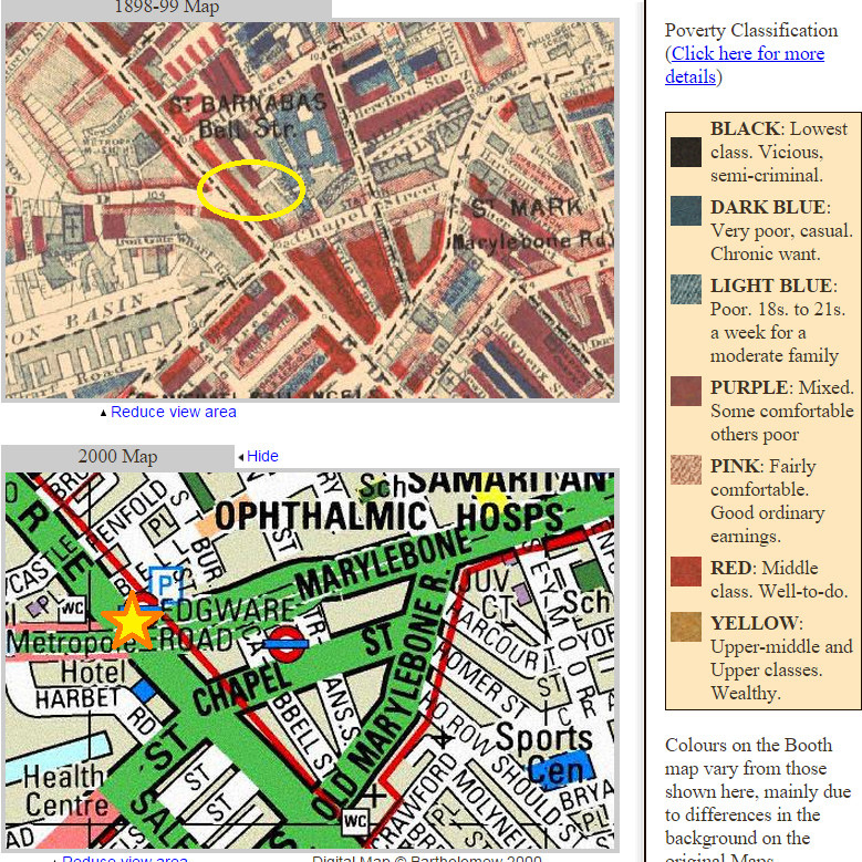
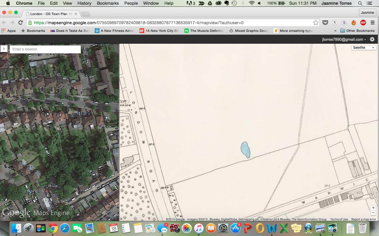
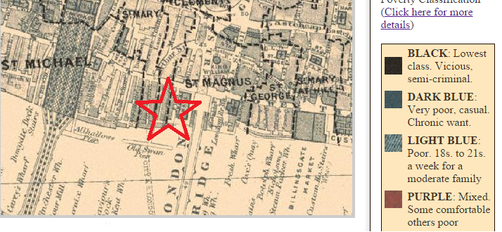
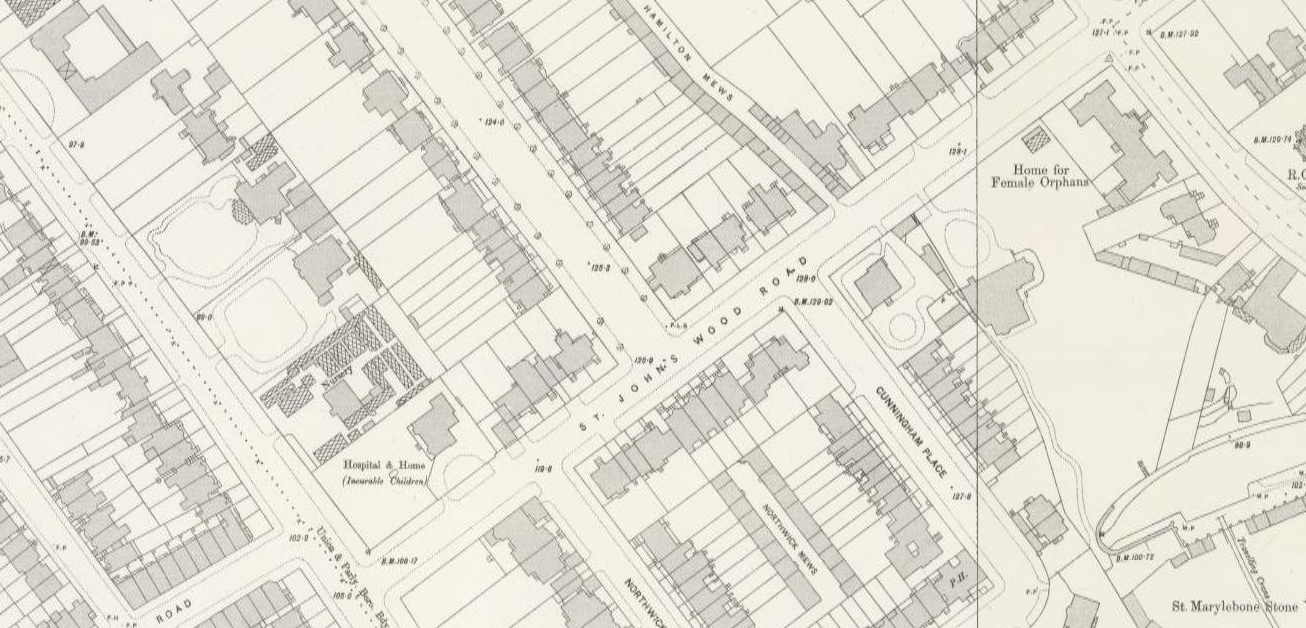
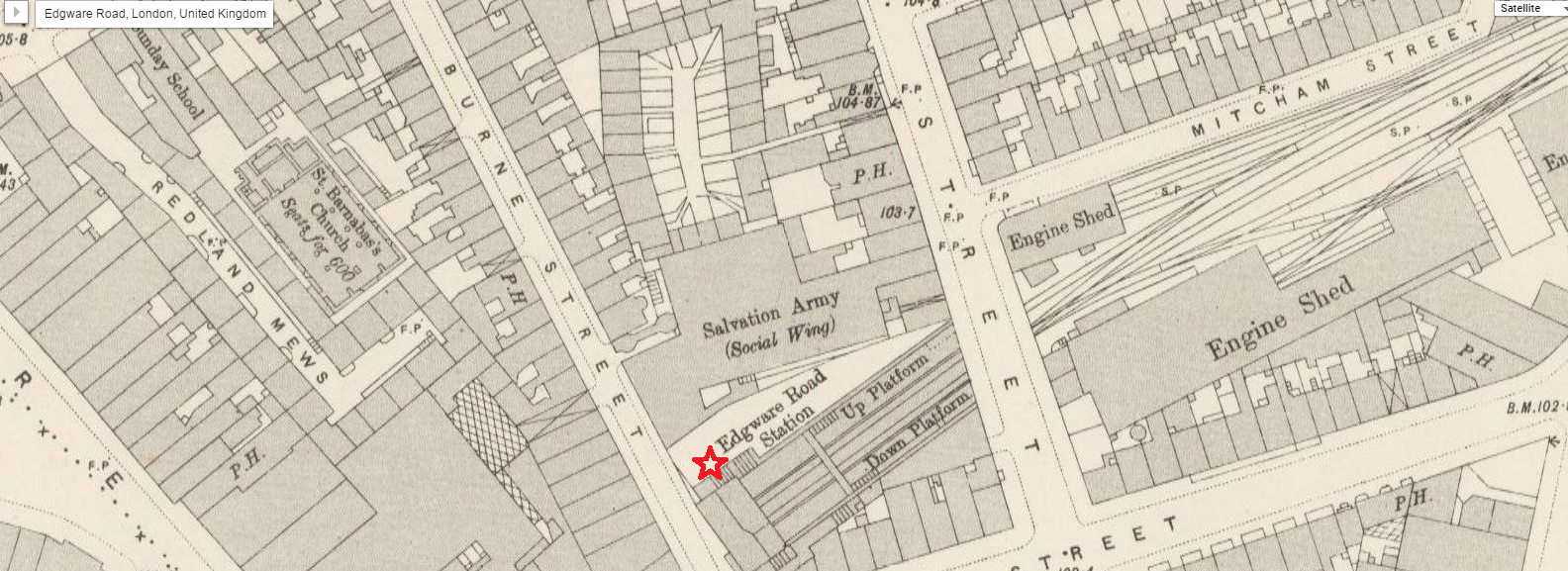
According to Google Maps, Edgware Road is called Edgware Road Station and is located off Burne Street, in the East end of London, where the Salvation Army “Social Wing” is located.  The surrounding area of Edgware Road consists of middle-class people who live on the fringes of society. These classes are both “mixed” and “poor,” as indicated by the red, purple and light blue indicators, according to “Charles Booth Online Archive: Booth Poverty Map and Modern Map.”  According to the Victorian Web in the article “The Origin and Early Development of the Salvation Army in Victorian England”,  the Social Wing of the Salvation Army, founded by William Booth, primarily concerned itself with both religious and social causes in an attempt to improve the lives of the poor souls living in poverty in the slums of London(The Victorian Web). The Methodist soldiers within god’s army targeted the poor in London’s East End.  In a highly sophisticated militaristic style and through the emphasis of prayer, Salvation Army members sought to redeem the downtrodden by providing nourishing meals and thus redeem them from damnation. Events took place in streets, the homes of members and in churches.

Regarding the story, Edgware Road identifies two important themes that involve: distorting class structure and woman as powerful, intelligent and clever agents of change despite their social class.  The importance of the Social Wing is emphasized through the different class structures around Edgware Road.  This highlights two instances within the context of the story in which class structure is blurred.  In the first instance, the astute Holmes points out that Irene and the King of Bohemia, who had a romantic liaison are on “very different level[s]” (“Scandal In Bohemia”,14).  Furthermore, Holmes indicates that although the King of Bohemia is of a higher social class, Irene has the greater intellectual ability and, therefore, is superior to the King, who idealizes her for her cleverness.  Holmes expounds upon the theory that a woman, regardless of her social standing, may be more resourceful and, therefore, more cunning than a man.  In the second instance, Holmes refuses to take the King’s priceless ring and upon doing so turns his back towards the King, indicating a distortion in social classes.  To Holmes, the status of the King or any other client is less significant than the captivating problem they present to him.

Edgware Road is an important location in the story entitled “Scandal in Bohemia” since it identifies St. Monica’s Church as the place where Irene Alder seeks solace and becomes an “honorable woman”.  Irene knows having engaged in an affair with a man without the benefit of marriage is immoral.  And, although she believes only the divine one knows the truth, she stealthily attempts to protect her image from social condemnation.  She is a direct nemesis of the King of Bohemia.


Works Cited


Doyle, Arthur. “Sherlock Holmes and the Scandal in Bohemia.” 1 June 1891. Print.

“Booth Poverty Map & Modern Map (Charles Booth Online Archive).” Booth Poverty Map & Modern Map (Charles Booth Online Archive). Web. 19 Oct. 2015.

Dr Diniejko, Andrzej. “The Origin and Early Development of the Salvation Army in Victorian England.” The Origin and Early Development of the Salvation Army in Victorian England. 10 Apr. 2013. Web. 19 Oct. 2015.

“Google Maps Engine: Map View.” Google Maps Engine: Map View. Web. 19 Oct. 2015.


Charing Cross

I researched Charing Cross in the Sherlock Stories. In “The Man with a Twisted Lip” Charing Cross is only mentioned when Sherlock says “I think, Watson,  that you are now standing in the presence of one of the most absolute fools in Europe. I deserve to be kicked from here to Charing Cross” (Doyle). This is when Holmes has figured out that Neville is Hugh Boone and the mention of Charing Cross is rather brief and insignificant. In “A Scandal in Bohemia” Charing Cross plays a bigger role. The woman at Irene Adler’s house explains that Irene “left this morning with her husband, by the 5:15 train from Charing Cross, for the continent” (Doyle). According to The Historical Eye, at Charing Cross there are “two railway stations within a stone’s throw of each other. One of these is the west end terminus of the South Eastern Railway, and the other is a station on the Metropolitan District Railway” (Historical Eye). Using Victorian Google Maps I could only find Charing Cross Station. However, the tracks appear to lead in the direction of the mainland, so it is likely that this is where Irene and her husband fled to in search of a train. The station isn’t technically on the road labeled Charing Cross. It is on West Strand which connects nearby. The map also shows that several different hotels surround the station, indicating that the immediate area was often full of tourists and travelers.

Charing Cross Station

Since the station played a larger role than road itself I looked more into it. According to the Charles Booth Online Archive, the area around the station was mostly well-to-do middle class or fairly comfortable people. This makes sense considering the amount of hotels (and likely other businesses). Having plenty of people coming and going would be good for business. When looking for information about the station on British History Online, I found a section that explained the havoc that had developed due to the creation of railways. The author quoted a writer of an illustrated newspaper who describes the building of railways rather negatively: “the task of destroying houses, or of snapping off odd bits of streets, and leaving maimed and melancholy fragments—unsightly, untenantable, forlorn débris; then the shapeless scraps of land, unneeded by the railway, and unavailable for other purposes” (BHO). This writer has nothing good to say about the railway and continues his rant by explaining “the abominable bridges that cross the roads at ugly angles; of the viaducts that provide dry arches for the congregation and accommodation of street Arabs and gutter children; of the cucumber frames that supply light and air to the underground traffic; of the colossal sheds of stations, notably those that mar the river’s banks” (BHO). It’s interesting that there was such a negative view on the railways while railways remained so important and relied on. This description of the railways shows that the railways had a double edge; they were useful for people to get around but also made a mess of the city. Unfortunately, these background details about Charing Cross don’t seem to reveal anything deeper about the stories. It’s a rather straight forward situation: Irene is fleeing to mainland Europe on a train which is presumably leaving Charing Cross Station. It could be important that there was actually a train station at Charing Cross. If Doyle had made a place up, or chosen a place where she could not have truly caught a train, it would have diminished the authenticity of Irene Adler, the woman who escaped Sherlock Holmes.

The Langham Hotel

Screen Shot 2015-10-18 at 6.57.13 PM Screen Shot 2015-10-18 at 6.52.14 PM


So the Langham hotel. In our story it is where the King was staying and doing his business with Miss Adler. In the story it claims that in 1865 it was a very grand and luxurious hotel. Which does make sense after using the Charles Booth website and looking at where it was located. The hotel was smack dab in the middle of the yellow and red parts of town, or the well a do and the upper middle and wealthy classes. This makes sense to why the King would be hanging out in this part of town. I wouldn’t expect a King to go to the poor part of town even if he was being scandalous.

After checking the Old Bailey I found out about some of the crimes that occurred in the Langham Hotel area. The results: little to no crime what so ever. Mainly robbery, fraud and forgery. Which makes sense in a way. For being such a ritzy area. Why would they need to commit crimes. In such a wealthy area they have all the money they would need. But there were a few other crimes that were a bit more serious. There was one of each man slaughter, housebreaking and sexual offense. In a way all of these major crimes I could see in the story. From when the King was sending his cronies to attack poor Lady Adler. He really wanted that picture back and though they didn’t go into details about the attacks, I’m sure these men definitely broke into her house and attacked her. Women weren’t really treated fairly as we have seen so far in this class and especially one that is under the sights of the King. I could only imagine what these goons were doing to her to try and get the picture.

Though the Langham hotel was in a very well off part of town that doesn’t ward off all crimes. It’s kind of like Wall Street today. Lots of undercover crimes that we will never know about. That’s actually probably why there are so little crimes on the Old Bailey. There were probably way more crimes but all probably got paid off and swept under the rug. Go money and rich people!

221B Baker Street

221B Baker Street, the infamous apartment of Sherlock Holmes, is a location many are aware of. The location features prominently in the story A Scandal in Bohemia. The street is nestled in the west end of London in a place called Marylebone. Marylebone is located in the borough of Westminster, the location of Parliament and Big Ben. This area was home to a large population of the middle, and upper middle classes, therefore it was considered a nice place to live. The Baker Street location is situated near two parks: Regents Park, and Hyde Park. These parks are yet another way to distinguish the appeal of this neighborhood. The University of Westminster is also a short distance from Baker Street. The labs of this particular Establishment could have been used, by Holmes, to pursue experiments, and use the equipment on the premises.

One might ask, how does this location add depth to the story A Scandal in Bohemia?  The location of Sherlock’s apartment would have been a reflection of his status in life, and based on the description of Irene Adler’s apartment they seem to be in the same class. That being stated, the fact that the two of them are equals not only intellectually, but also in the social structure would say a lot. Women, at this time, were seen as inferior to their male counterparts, but not Irene Adler. Not only does she outwit Mr. Holmes, but she also seems to have a better apartment, and a better geographic location of said apartment. While Holmes lives in between two parks, Adler seems to live right across the street from a park. It is also suggested the two of them live very close to one another. She follows him to Baker Street, alluding that it wouldn’t pose a problem for her to follow him.

The location of the infamous Baker Street shows how important Class was to the Victorian Era society.

Swan Lane- The Man with the Twisted Lip

Upper Swandom Lane, or Swan Lane as it was actually known, is the location of the opium den in the Sherlock Holmes story, “The Man with the Twisted Lip” by Sir Arthur Conan Doyle. It is from this den that Neville St. Clair supposedly disappears. It is the last place that his wife sees him and foul play is suspected by his family, the police, and Holmes. Eventually it is revealed that St. Clair was not missing at all, simply living his double life as a successful beggar from his base above the opium den.

In real life, Swan Lane is a street adjacent to London Bridge on the north side of the River Thames. As seen from the Victorian google map, the southern end of the lane juts against the river and is sometimes underwater at high tide. This becomes a plot point in the Holmes story as Mr. St. Clair throws his coat out the window and into the river when he hurriedly transforms into his beggar self. This action leads the police to believe that Neville St. Clair has met a terrible fate.

SwanLane

As can be seen from the Booth Poverty Map of the region, this street was one of the poorest in London. It is little wonder an upstanding citizen disguised as a beggar would make his base here as he would blend in so well with the surrounding socioeconomic environment. No one who knew St. Clair would ever think to look for him amongst the riffraff hanging around the docks.

SwanLakeCharlesBooth

Shown by the black marks on the map, Swan Lake was also a hotbed of criminal activity. It is little wonder then that Dr. Watson runs into Holmes investigating a crime on the street or, as Holmes notes, that it is so common for people to disappear from the very opium den in question.

Doyle, Arthur Conan. The Man with the Twisted Lip. N.p.: n.p., n.d. Print.

“Booth Poverty Map & Modern Map (Charles Booth Online Archive).” Booth Poverty Map & Modern Map (Charles Booth Online Archive). N.p., n.d. Web. 18 Oct. 2015.