https://docs.google.com/spreadsheets/d/19ASyLO572tMV7HuS61gwKD4StsjOpKEjv65A2lAkwJk/edit#gid=0
Fall 2015 Blog
Use this category tag on all blog posts for Fall 2015.
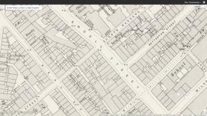
Endell Street, London
Endell Street is from the Sherlock Holmes story of The Blue Carbuncle. The street itself doesn’t have much importance in the book because it was only used as a cut through area to get to another place, just like everyone does if they are trying to get somewhere faster. According to the British Online History site Endell Street was a commercial street. There was also a parish that closed and then donated money to the parish on Endell Street. As well as getting money from that parish they also got their church bells donated to them. The street didn’t have any effect on the plot of the story at all.
University of London. Web. 11 Nov. 2015. <http://www.british-history.ac.uk/search?query=endell street>.
Victorian London Locations Assignment
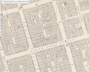
For my Victorian London Locations Assignment, I chose Wimpole Street as my location to research.
– Wimpole Street was named after Wimpole Hall, a palatial house in Cambridgeshire.
– Wimpole Street was known for it’s many doctors, opticians, and dentists whose practices were along the street.
– Sir Arthur Conan Doyle himself opened his ophthalmic practice in Upper Wimpole Street in 1891. He began writing short stories when, “five or six months later, … not one single patient had ever crossed the threshold” [a colourful exaggeration that he later contradicted].
The inclusion of Wimpole Street in Blue Carbuncle, although very brief (simply listed as a name along with several other streets), was meant to relate to and seem more realistic for the audience reading the story. Wimpole Street attracted “the cream of London society” where much of the Upper Class visited or resided. Being that a good portion of the audience who read Holmes stories were of the upper class, mentioning Wimpole Street made for a much more compelling story.
*Non Victorian London Fact about Wimpole Street* Paul McCartney actually wrote “I Wand To Hold Your Hand” and “Yesterday” at 52 Wimpole Street while staying with his current girlfriend’s parents.
Source: Willey, Russ. “Wimpole Street – Hidden London.” Hidden London. N.p., n.d. Web. 8 Nov. 2015.
mapping victorian london- edgware road
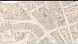
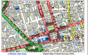
This is a screenshot from google maps of Edgware road, the address mentioned in “Scandal in Bohemia,” only briefly, in a single sentence spoken by Irene Adler’s fiancee in the cab that was taking them to the church. Edward road was indeed the location of the chapel where Godfrey and Adler tied the knot, with a priest and Sherlock, who was disguised as a peasant to be the witness.
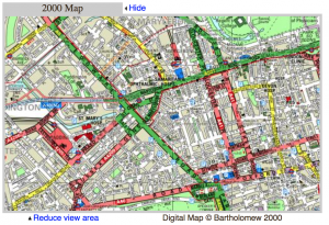
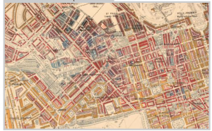
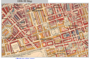
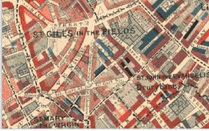
These maps of the same area, in the present (left), and the victorian period (right) display Edgware Road (hi- lighted in green on the left) was a main road from Charles Booth Online Archive. According to this archive, the area surrounding the street is marked with quite a bit of red, or “well to do” according to The Booth archive. just like the story states, this is quite a ritzy area and Irene was married in an extravagant chapel. Irene being a woman of class and taste, this location reflects accurately upon her standards. According to “Locating London,” the area around Edgware street was famous for having many churches (which is fitting for the role the street plays, being where the church Irene is married in is located). According to old bailey online archive, there was not a ton of violent crime, not a very dangerous area. The occasional theft is what is shown in the archive’s records. an interesting fact about Edgware Road is that at the end of the Victorian period it became a highly populated jewish area, with the building of many synogogues at the end of the era, according to the Booth online archive and Locating London.
these more close-up images go more in-depth with the exact neighborhood wealth statuses, yellows (upper-class/ wealthy), pinks (comfortable/good earnings), but mostly reds in the neighborhoods branching off of and surrounding the street.
Charing Cross in A Scandal in Bohemia
In The Sherlock Holmes novel, “A Sca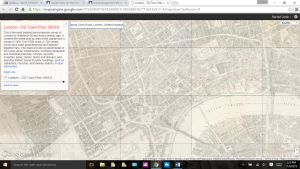 ndal in Bohemia”, Charing Cross/Charing Cross Station is merely mentioned in passing and is ultimately where Irene Adler escaped to with her newly wedded husband to some unknown location. In the story, the location has nothing to do with any crimes but it does add to the mystery that is Adler’s character. All in all, Sir Arthur Conan Doyle uses Charing Cross to his advantage in furthering Irene Adler’s elusive character. However, according to Old Bailey Online, an archive of the proceedings of London’s Central Criminal Court, at the time in real life there were many instances of theft/simple larceny. (Oldbailyonline.net)
To provide some background into the location, Charing Cross and Charing Cross Station are very close to The West Strand which, according to “The Historical Eye”, “In the e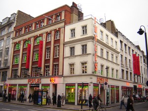 vening, the footpath on the right just outside Charing Cross station is occupied by a more or less regular road of energetic new tenders and somehow, standing here, one feels that one is in touch with the whole civilised world.” However, The West Strand today is described in a much
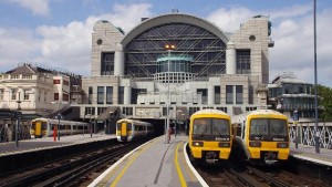 more negative light, “This part of the Strand is still one of London’s busiest streets, with Charing Cross station disgorging commuters in the morning and hoovering them back up in the evening.” (historicaleye.com)
According to the Booth Poverty Map, the residential areas around Charing Cross are all quite wealthy, which i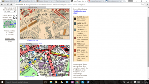 s the case with many of the locations mentioned in “A Scandal in Bohemia”. (booth.lse.ac.uk)
Citations
“Booth Poverty Map & Modern Map (Charles Booth Online Archive).” Booth Poverty Map & Modern Map (Charles Booth Online Archive). N.p., n.d. Web. 09 Nov. 2015.
“The Historical Eye.” Fleet Street and Strand. N.p., n.d. Web. 09 Nov. 2015.
“The Proceedings of the Old Bailey.” Results. N.p., n.d. Web. 09 Nov. 2015.
Bow Street Police Court
In the tale of “The Man with the Twisted Lip”, Holmes is attempting to solve a mystery of a missing man. The biggest and most important plot twist of this story takes place at the Bow Street Police Court. The Police Court is also important to the theme of the story because it is based around crime and the Police Court is where criminals go. The Bow Street Police Court is vital to this story because the court house is where Holmes uses his handy sponge to reveal that the missing man has been using a disguise. He had disguised himself as a Holmes person using dirt so when Holmes used his sponge to clean off his face, it is revealed that this homeless man was the missing man all along. A few interesting facts about the Bow Street Police the first police is that the first one opened. Also “The present aspect of the street is determined by two factors: its function as part of a through-route from Waterloo Bridge to St. Giles’s and Bloomsbury, and the public or semipublic nature of the large buildings that front upon it. Originally, however, the street did not form part of an important line of communication, having no northward opening into Long Acre (Plate 7), and until the building of Smirke’s Covent Garden Theatre in 1809 was essentially the usual street of houses, shops and taverns.” (London, 1970) 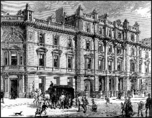
Work Cited:
http://www.locatinglondon.org/
http://www.british-history.ac.uk/survey-london/vol36/pp185-192
Waterloo Bridge Road
This is the location of the Waterloo Bridge in London. Within this area it is common to have small thefts such as animal thefts, pick pocketing, small grand larceny and many more. Not only is it a source of crimes but it is a site of factories. To add to that the location around the Waterloo Bridge was generally middle class with glimpses of fairly comfortable households (earning wise).
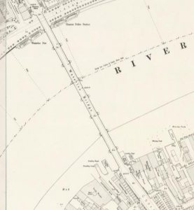
When it comes to the crimes in London specifically on or right next the Waterloo Bridge there are a few examples of pick pockets as well as the strange animal theft. It was a case of a man named Thomas Jones in 1694 stole 7 tamed pigeons, why you might ask, the source has no reason to the act only the report of what happened.
“1694. THOMAS JONES was indicted for stealing, on the 19th of July , 7 live tame pigeons, price 5s. , the property of John Simmons Winterflood and John Brown .
ROBERT DUKE . I am an officer. On the 19th of July I searched the prisoner’s room in Steward’s-rents, Drury-lane, and found seven live pigeons; the prosecutor claimed them.
JOHN SIMMONS WINTERFLOOD. I know the pigeons – they were the joint property of myself and John Brown; I had seen them the day before on our coal-wharf, at Waterloo-bridge – the prisoner was in our employ – I would take him back again.
GUILTY . Aged 21.
Fined One Shilling and Discharged .(Old Bailey)
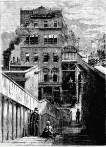
Now when it comes to the factory business around the bridge it was mostly local, for example there was a factory built shortly after the water-works were opened, “…a large shot factory was built close by, together with a fine wet-dock for the loading and warehousing of goods.” (British-history.ac.uk) since they were built near each other it helped the production, export and import rate. Later on they would open another shot manufacturer by Messrs Watts in the year 1789. This factory stood over 140 feet tall and is shown in the picture below.
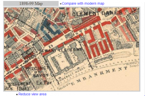
Finally the levels of poverty in the area. According to the Charles Booth Archive map, it is shown that the poverty level around the Waterloo Bridge was relatively middle class with glimpses of Comfortable living households. This could be a reason for the pick pocketing crimes, due to the higher wealth the more poor people would come to this bridge (due to it location and how there were always people on it).
The way the Waterloo Bridge relates to the Sherlock Holmes story, The Man with the Twisted Lip; is that within the story at one instance it describes the location of the bridge and how it is used among the citizens surrounding it;
“In town the earliest risers were just beginning to look sleepily from their windows as we drove through the streets of the Surrey side. Passing down the Waterloo Bridge Road we crossed over the river, and dashing up Wellington Street wheeled sharply to the right and found ourselves in Bow Street. Sherlock Holmes was well known to the force, and the two constables at the door saluted him. One of them held the horse’s head while the other led us in.” (Eastoftheweb.com)
It describes it as a place at which in one point of the day everyone would have crossed it.
References
Booth.lse.ac.uk,. ‘Booth Poverty Map (Charles Booth Online Archive)’. N.p., 2015. Web. 9 Nov. 2015.
British-history.ac.uk,. ‘Lambeth: Waterloo Road | British History Online’. N.p., 2015. Web. 9 Nov. 2015.
Eastoftheweb.com,. ‘Short Stories: The Man With The Twisted Lip By Arthur Conan Doyle’. N.p., 2015. Web. 9 Nov. 2015.
Oldbaileyonline.org,. ‘Results – Central Criminal Court’. N.p., 2015. Web. 9 Nov. 2015.
Victorian Locations: Langham Hotel (Langham Place)
While the Sherlock Holmes stories are fictional, they occur in actual places. Langham Hotel, located on Langham Place, is significant in the story “A Scandal in Bohemia.” The first map is a modern one of Langham Hotel, the second is a satellite image, and the third is from the London Town Plan of 1893-6. I placed markers over the areas I’ll be focusing on.
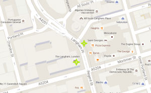
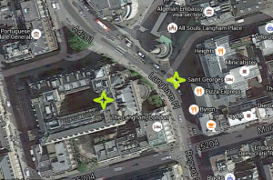
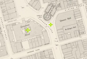 In the story, the King of Bohemia visits Holmes and Watson asking for their detective assistance. The King is staying at the Langham Hotel under the name Count Von Kramm (Doyle). According to Charles Booth’s Poverty Maps, Langham Place (specifically the hotel) is predominantly upper middle class, and upper classes (Charles Booth).
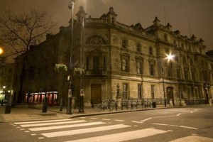
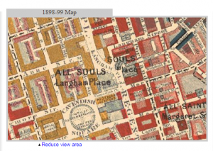 It’s no surprise that Conan Doyle decided to have the King stay here, given it’s decadence. The sheer extravagance of the hotel can be seen in this picture from Google Maps–
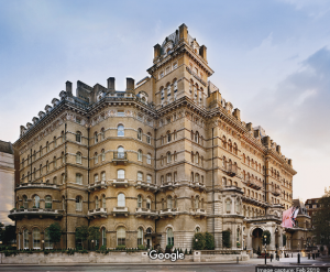
According to British History Online, the price to build the hotel was £300,000. It has been hosting guests since 1865, and the opening ceremony was performed by the Prince of Wales. It is still considered to be one of the largest buildings in the city, and one of the best preserved traditional hotels in London (British History Online).
By looking at Old Bailey trials concerning the Langham Hotel, it’s usually not the scene of a crime, but instead used as a landmark to identify where someone was when the crime happened. In Frances John Harris’ trial, the clock opposite the Hotel is used as a landmark (“Frances John Harris, Royal Offences”). Or, the staff at the Hotel are asked for statements. In the case of Stephen Cullen, a woman interviewed was the kitchen maid at the Langham Hotel (“Stephen Cullen, Killing”).
Overall, the Langham Hotel is an important part of both the Sherlock Holmes stories and life in London.
Works Cited:
Victorian London Locations: Covent Garden Market
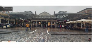
The Covent Garden Market was known for being a noisy, lively market place in the Victorian era, where people from around the neighborhood would come to buy and sell various goods. The market itself has been a hub for purchasing fresh fruits, vegetables, and herbs for several hundred years and the surrounding church, pubs, and theaters also gives the square an array of activities and sights to see. However, the Covent Garden Market has not always been such a friendly place to take a trip to with the family. Ironically enough, the area used to be used for orchards for the Westminister Abbey and by the 18th century, the area became a well-known red-light district, attracting prostitutes, playwrights, and street performers. The area was quickly cleaned up and organized back to being a market place for the town. Although the site now serves as more of a tourist location, to this day people still continue to visit the cafes, pubs, and small shops the Covent Garden Market has to offer
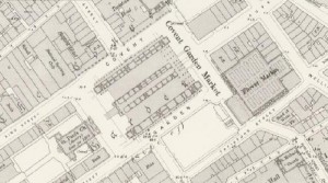
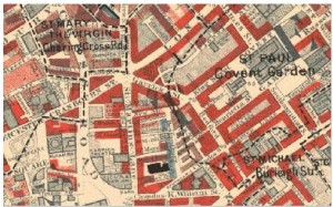
- .Covent Garden Market map view for Victorian London
In the Sherlock Holmes story “The Adventure of the Blue Carbuncle” by Arthur Conan Doyle, Sherlock mentions and visits the Covent Garden Market. In the story, the characters are said to pass through the slums of Endell Street to get to the market place to hassle the salesman and find out where the goose with the precious gem came from. By using the Charles Boothe Online Archive, we as the readers can see that on Endell Street there are parts where poverty is prevalent and where thievery and criminal activities were more likely to happen.
The Charles Boothe Online Archive also shows us that the market place, as well as the surrounding area, are where the middle to upper class resided. This evidence along with the Old Bailey Proceedings, lead the readers to believe that because of this social class gap, criminal activity was very common around these parts.
Work Cited:
Doyle, Sir Arthur Conan. The Adventures of Sherlock Holmes. The Adventure of The Blue Carbuncle. Web. 8 November 2015. http://ignisart.com/camdenhouse/canon/blue.htm
Charles Boothe Online Archive. Web. 8 November 2015.http://booth.lse.ac.uk/cgi-bin/do.pl?sub=view_booth_and_barth&args=530156,180800,1,large,0
Locating London. Web. 8 November 2015. http://www.locatinglondon.org/index.html
Victorian London Locations: Swan Lane
Swan Lane, or ‘Upper Swandam Lane’ is a street featured in the Adventures of Sherlock Holmes short story titled “The Man with the Twisted Lip”. It is the street where the infamous opium den – “Bar of Gold” is located. Mrs. St. Clair went to pick up a package on Fresno Street when she stumbled upon Upper Swandam Lane on her way back home from running errands, and “she did not like the neighborhood in which she found herself.” Clearly there are no noble deeds or productive work being done in this kind of an area.
One interesting fact I would like to point out about this area is that the poverty classification for the time period of 1898-9 (ten years after Twisted Lip took place in 1889) was considered “poor”. In the story, the den was even located “between a slop-shop and a gin-shop”. A slop-shop is defined as ‘a store in which cheap, ready-made clothing may be purchased.’ I recall earlier in the semester that the rise of ready-made clothing made clothes cheaper and could disguise a person’s class better since anyone could buy the same clothes from a department store. And the latter, a gin-shop is obviously where one can purchase alcohol (opium and alcohol – probably not the best mix!). 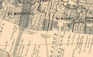
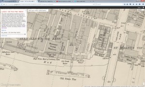
Another interesting fact is that on the Charles Booth Poverty map, there is not much indicator of class in the area of Swan Lane. Where there is color, though, it is light blue, meaning “poor”. Our professor actually pointed out to me that the reason for the absence of classification for a good portion of the area is that there might’ve been factories there. I do know that the ‘wharves’ near it (mentioned in the story) were for vessels to lie at rest, and to load or unload on piers. London OS Town Plan shows ‘Old Swan Pier’ directly south of it in the river.
To my surprise,when I was looking up crimes on the Old Bailey website there wasn’t much to find. Swan Lane (during the period of 1674 to 1834) only had 2 associated trials (one was a theft, the other a ‘royal offense’ – more specifically, coining offense – neither one indicated violence). However, it is located next to a high-crime area, George Alley, which was associated with ’23 or more’ trials. In the story there was actually mention of an alley. Mr. Watson said “Upper Swandam Lane is a vile alley lurking behind the high wharves…” There is no mention of George Alley, however. Maybe Swan Lane had more of a reputation for crime in the year 1889, or maybe Sir Arthur Conan Doyle just chose this location to spice things up in London. He might’ve met to associate the probably-infamous George Alley with the nearby Swan Lane.
I do think, however, that Doyle made a bit of a slip-up in where Swan Lane is located. In the story, Watson says that Swan Lane lines “the north side of the river to the east of the London Bridge.” While Swan Lane does lie north of the river, it is actually to the west of the London Bridge, which I have seen reflected on several different maps.
Another street mentioned in the story is Fresno Street, where Mrs. St. Clair picked up a package nearby. The story indicates that it was walking distance away from Swan Lane, but I have searched both maps and there is no Fresno Street. Maybe Doyle wanted to create a nice area nearby where she would have been running her errands but have been close enough to stumble into a rough neighborhood. But since much of the real area was poor, I don’t believe such a place actually existed.
Upper Swandam Lane is a central location to the story in regards to the plot and theme. There are themes of class and crime in this story. Holmes even refers to the den as a “murder trap” and says that many people have died in that den (page 131). Both Watson and Holmes’ sentiments toward that particular street are negative. And for the plot, Swan Lane is where Neville St. Clair goes in as a well-dressed man and is able to come out in disguise as a beggar every single day as he pretends to go to work. It is also where his wife sees him looking out of the window of the den, and where Isa Whitney is found completely belligerent off of opium in a room full of men under the same influence. It is a very sketchy area to say the least, and a sad picture of addiction.
Sources:
Adventures of Sherlock Holmes – The Man with the Twisted Lip
Booth Poverty Map and Modern Map
Place and Map Search for Swan Lane Old Bailey
-Miranda Delancey
