Piccadilly

Screen Shot 2015-12-02 at 7.40.13 PM

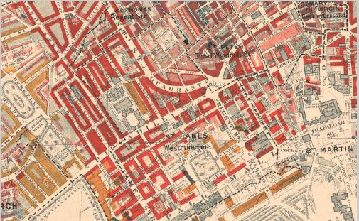
With development starting as early as the sixteen hundreds, Piccadilly runs across London and serves as the main highway that connects the west end to the east end (Piccadilly, Southside). Piccadilly runs just north of Green Park and south of the Royal Academy and meets Regent Street at the famous Piccadilly Circus. Not only did Piccadilly serve as the gateway from the West to the metropolitan area of England, but it was also the site of many newly erected mansions throughout the seventeenth century. Right from the beginning of Piccadilly’s history, the street has been an area of wealth, as we can see on the Booth Online Poverty Map.

Screen Shot 2015-12-02 at 7.44.05 PM

Due to the area’s apparent wealth, throughout history, this area has been the setting for political grounds. In the article, “Mansions in Piccadilly,” we learn that, “For a century and a half this house has been one of the special rendezvous of the Whig party. “Three palaces in the year 1784,” writes Sir N. W. Wraxall, “the gates of which were constantly thrown open to every supporter of the ‘Coalition’ (against Pitt), formed rallying-points of union.” One of these was Burlington House, then tenanted by the Duke of Portland; the second was Carlton House, the residence of George, Prince of Wales; the third was Devonshire House, which, ‘placed on a commanding eminence opposite to the Green Park, seemed to look down upon the Queen’s House, constructed by Sheffield, Duke of Buckingham, in a situation much less favoured by nature.'” Due to Piccadilly’s plethora of wealth, many shop owners, especially booksellers, started opening up stores in what is now known as one of the most famous shopping areas of London. Many book shops and publishing houses were opened up, and by, “1850 or 1851 the firm of Chapman and Hall came from the Strand to No. 193 Piccadilly, where it remained until its removal to Henrietta Street, Covent Garden, in 1881. Chapman and Hall’s authors included the Brownings, Trollope, Meredith and Dickens” (Piccadilly, South Side). This area became more and more popular, especially for authors and other cultured people. Soon enough, the Royal Academy was developed right off Piccadilly, as well as restaurants, inns, and many more shops.

As Dorian describes how he met Sibyl Vane to Lord Henry, he begins by telling Lord Henry, “As I lounged in the Park, or strolled down Piccadilly, I used to look at every one who passed me, and wondered, with mad curiosity, what sort of lives they led” (52). We learn that Dorian, instead of roaming around the wealthy, cultured neighborhood of which he was a part, decides to head eastward in order to find true beauty. It is interesting that Dorian, although immersed in the arts, wealth, and beauty of Piccadilly, felt he needed to seek true beauty elsewhere; this detail, in my opinion, foreshadows Dorian’s spiral downward. He no longer finds beauty in the intellectual and artistic aspects of his upper-class life, rather finds amusement through grime and sin.

Works Cited

“Piccadilly, South Side.” Survey of London: Volumes 29 and 30, St James Westminster, Part 1. Ed. F H W Sheppard. London: London County Council, 1960. 251-270. British History Online. Web. 1 December 2015.

Walford, Edward. ‘Mansions in Piccadilly.’ Old and New London: Volume 4. London: Cassell, Petter & Galpin, 1878. 273-290. British History Online. Web. 1 December 2015.

Wilde, Oscar. The Picture of Dorian Gray. New York: Barnes & Noble Books, 2003. Print.

Burlington Street and Arcade

Screen Shot 2015-11-27 at 8.00.03 PM

In The Picture of Dorian Gray, we learn about Dorian’s mysterious family history through Lord Henry’s uncle, Lord George Fremor. As Lord Henry leaves his uncle’s house, Wilde writes, “Lord Henry passed up the low arcade into Burlington Street, and turned his steps in the direction of Berkeley Square. Upon leaving his uncle, Lord Henry tells him how he will be having lunch with Aunt Agatha’s, who seems to live in the same well-off area as Berkeley Square is in. Burlington Street, which is actually called Old Burlington Street, runs parallel to Burlington Garden, which parallel to, yet accessible through the Burlington Arcade.

Screen Shot 2015-11-27 at 8.05.41 PM

The Burlington Arcade, which was started in May 1815, serves as the entranceway for The Royal Academy of Arts, the Burlington House, and the University of London. This area is extremely well off, as we can see on the Booth Poverty Map.

Screen Shot 2015-11-27 at 8.36.31 PM

The Burlington Arcade, which is virtually the only passageway into Burlington Gardens, was one of the first confined establishment of high-end shops, as explained in the article “Burlington Arcade:”

aba-c-aba-c-aba-c-aba-d: Here ‘a’ represents a ‘double’ shop, with small display window flanked by doors and by larger display windows, and one storey visible above where one plain window is flanked by two bay windows; ‘b’ represents two smaller, separate shops, or ‘single’ shops, with one visible storey above them, where two plain windows are between two bay windows; ‘c’ is a heightened version of ‘a’ and takes the place of the ‘inter-shop’ spaces or ‘saloons’ earlier proposed, the three-storey fronts being set back from the building line; and ‘d’, between street entrance and first arch, represents one ‘single’ shop plus one double shop splayed back from the street entrance. The width of the passage at each arch is constant, some 12 feet.

Burlington Arcade was most known for its architecture and ability to house so many small shops. This is significant to Wilde’s story because it really exhibits how well off Lord Henry and Dorian Gray seem to be. Lord Henry’s route through Burlington Arcade and (Old) Burlington Street may be related to the story he just heard about Dorian’s family. Upon hearing the oddly mysterious story, Lord Henry walks toward an extremely well off area of London, which could represent Dorian Gray’s wealth, despite his obscure family history.

Works Cited

“Booth Poverty Map. Charles Booth Online Archive. London School of Economics and Political Science. Web. 27 November 2015.

‘Burlington Arcade.’ Survey of London: Volumes 31 and 32, St James Westminster, Part 2. Ed. F H W Sheppard. London: London County Council, 1963. 430-434. British History Online. Web. 27 November 2015.

Victorian Google Maps.

Wilde, Oscar. The Picture of Dorian Gray. New York: Barnes & Noble Books, 2003. Print.

Euston Road

Screen Shot 2015-11-15 at 6.51.23 PM

In Oscar Wilde’s The Picture of Dorian Gray, Dorian Gray’s fiancé, Sibyl Vane, lives on Euston Road with her mother and brother James. Euston Road runs parallel to the Thames, between The Regent’s Park and Hyde Park, and is the closest main road to the Euston Station, which connects to the road via Euston Grove (Victorian Google Maps). Camille Cauti, who provides the Introduction and Notes for my edition of Dorian Gray, comments that Euston Road is a, “Street in North London lined with inexpensive lodging” (69). Euston Road, originally called the “New Road,” was sanctioned to be built in 1756 to connect Paddington and Islington within London (Walford, “Euston Road”). Not only was the road constructed to further connect one end of London to the other, but Euston Road was also meant to provide a residential living area for the growing population of London: “The result was that the road was wholly residential, with long gardens in front of the houses and this pleasant effect was increased by laying out open squares which faced one another, such as Park Square and Crescent, Endsleigh Gardens and Euston Square. Mackenzie’s view (Plate 82a) shows the road in 1825 at the height of its fashion” (“Euston Road”). But by the time Oscar Wilde was writing Dorian Gray though, which would be at least fifty years from 1825, the beauteousness of Euston Road seemed to fade into what Wilde refers to as, “the dreary Euston Road.” (Wilde, 69). In the novel, Sibyl suggests to Jim that they visit the Park, unto which Jim responds, “‘I am too shabby,’ he answered, frowning. ‘Only swell people go to the Park” (Wilde 67). The siblings decide to go to the Park that is above their class anyway, and must walk down Euston Road to reach the Park. Sibyl and Jim’s walk down Euston Road is important in understanding Sibyl’s shift from poverty to prestige–or at least the facade of prestige that Dorian Gray is as a park is to nature. Euston Road, both historically and fictionally, seems to represent a type of transition, or rather fading, from one state of being to another.

Camille Cauti, Introduction. The Picture of Dorian Gray. By Oscar Wilde. New York: Fine Creative Media Inc., 2003. Print.

“Euston Road.” Survey of London: Volume 24, the Parish of St Pancras Part 4: King’s Cross Neighbourhood. Ed. Walter H Godfrey and W McB. Marcham. London: London County Council, 1952. 114-117. British History Online. Web. 15 November 2015.

Victorian Google Maps. Google Imagery 2015. 

Walford, Edward. ‘Euston Road and Hampstead Road.’ Old and New London: Volume 5. London: Cassell, Petter & Galpin, 1878. 301-309. British History Online. Web. 15 November 2015.

Threadneedle Street

Screen Shot 2015-10-18 at 5.58.57 PM

Threadneedle Street is a street in which the characters of Doyle’s short story, “The Man with the Twisted Lip,” part of The Adventures of Sherlock Holmes, refer to as the City. The story starts off with Watson on a mission to retrieve a friend from the opium den on Swandam Lane, and while at the opium den, runs into Sherlock Holmes, who is there investigating the potential murder of Mr. Neville St. Clair. The prime suspect for St. Clair’s murder is the poor beggar, Hugh Boone, who lives in the apartment above the opium den. Hugh Boone is described as a decrepit beggar who, “though in order to avoid the police regulations he pretends to a small trade in wax vestas. Some little distance down Threadneedle Street, upon the left-hand side, there is, as you may have remarked, a small angle in the wall. Here it is that this creature takes his daily seat…” (7). This description, given by Watson is important in not only figuring out the mystery of the story, but also what Threadneedle Street was like during the early nineteen hundreds.

Threatneedle Street is the street that runs parallel to Cornhill and perpendicular to Bishopgate Street, forming a triangle north of the Thames River. The triangle these three streets form is the center of business in London, as the Royal Exchange and Bank of London are located between the three streets (Victorian Google Maps). The Royal Exchange, started by Mr. Edward Moxhay in 1830, under the name The Hall of Commerce, as an area for merchants to gather and trade without the threat of larger, monopolizing businesses (Thornbury). Due to it being the home of the Royal Exchange, Threadneedle Street is important to understanding the context of Doyle’s story. Threadneedle Street is where Hugh Boone “works,” because even for a beggar there is more opportunity in the heart of the city, as opposed to where he lives, which is in the opportunity-less slums. Doyle’s inclusion of the contrast between a beggar’s opportunity in the City and by the opium dens suggests how it is inevitable, even if one needs to be a beggar, to be a part of modernized London.

Threadneedle Street is also the home of the Bank of London, the Jewish synagogue-turned-school-turned-Church-turned-bank (Thornbury). The Bank of London is not only significant to this location in real life as well as the plotline of “The Man with the Twisted Lip,” due to its obvious financial role, but also due to the vast history the establishment holds. The Bank’s history reinforces how diverse and important of an exchange place Threadneedle must have been especially during the eighteenth and nineteenth century. Before the building was an active part of the financial-driven part of London, it went through many different stages of being social and institutional centers, thus proving the importance and versatility of this area; no wonder why Boone decided to beg there. Not only is the Bank of London located on Threadneedle, but also the street is lined with dozens of other smaller banks and exchanges (Victorian Google Maps).

In terms of theme, Threadneedle Street is significant in displaying the layered contrasts between the working class of London, the beggars of London, and the “CEOs” of London, which allows readers to understand and imagine 1850-1900’s London with more clarity. The City, which is how the characters of the story refer to the Threadneedle district, is a melting pot of all the different prototypes that make up the capitalist, modern system in which London has developed due to the introduction of industrialization. Due to the competition introduced by industrialization, small merchants such as Mr. Moxhay found it integral to create a space in which more fair competition can exist. In doing so, the financial world created itself around the merchants’ power to congregate and establish grounds and due to the district’s financial boom, others, such as beggars, also establish themselves and function around the systems established. This multi-layered development of what Threadneedle Street represents is the beginning of London’s full-fledged transformation into the modern City.

Works Cited:


Doyle, Sir Anthony Conan. “Adventure 6: The Man with the Twisted Lip.” The Adventures of Sherlock Holmes. London: George Newnes Ltd, 1892. Florida Center for Instructional Technology, College of Education, University of South Florida. 2015. Oct 18 2015.

Thornbury, Walter. “Threadneedle Street.” Old and New London. Vol. 1. London: Cassell, Petter & Galpin, 1878. 531-544. Oct 18 2015.

“London – OS Town Plan 1893-6.” Google Maps Engine. Google-Imagery TerraMetrics, 2015. Oct 18 2015.

Chelsea: Connecting East and West London

Screen Shot 2015-09-10 at 12.43.45 AMLocated in the northwestern region of London, Chelsea was a predominantly well-off and bustling neighborhood that revolved around Chelsea Rd. and the Chelsea Rd. Bridge. In “A Lost Masterpiece,” the main character (who remains nameless) makes his way to the Chelsea wharf and there loads a steamer to travel east up the Thames River. Interestingly enough, Chelsea’s wharves were the first ferry transportation portals along the Thames River, which made Chelsea a fast-developing part of London. In 1816, the steamboat was introduced to the Thames River and by the 1830’s steamboat traffic was  booming, especially between Chelsea Bridge and London Bridge. Not only did the town of Chelsea serve as a gateway due to the many wharves that popped up along the Thames, but the Chelsea Bridge also became one of the most used roads/highways by this time as well, as it connected the Royal Hospital to the rest of London .

The Chelsea Bridge was erected sometime during the 15th century, under the name Battersea Bridge, but with the introduction of auto-transportation, Chelsea’s reputation of being a travel hub continually grew. With so much access to and from Chelsea, it seems as though during the Victorian Era, and probably the eras to follow as well, Chelsea was a major part of London that really allowed Londoners to use the Thames River for travel. The article, “The parish of Chelsea: Communication,” explains, “in 1844 eight steamboats travelled between London Bridge and Chelsea, four times an hour, and traffic was increasing. Chelsea vestry saw steamboats – quick, cheap, and comfortable – as potentially the common transport of residents of the densely-populated shore.” Egerton’s main character makes this journey in “A Lost Masterpiece,” which is significant because Chelsea Bridge and wharf is what connects the Western wealthy end of London to the slummy, factory ridden east end. The Booth Poverty map shows that during the Victorian era, the areas in and around Chelsea were populated well-to-do- middle-classers, while the area around London Bridge is shaded to indicate the poverty and crime. Chelsea’s bringing together of the contrasting regions of London is also apparent in the way the main character describes his observations once getting off the steamer by London Bridge. He does not see the filth and poverty surrounding him, rather finds the east-end of London delightful and curious:

“The youth played mechanically, without a trace of emotion; whilst the harpist, whose nose is a study in purples and whose bloodshot eyes have the glassy brightness of drink, felt every touch of beauty in the poor little tune, and drew it tenderly forth. They added the musical note to my joyous mood ; the poetry of the city dovetailed harmoniously with country scenes too recent to be treated as memories—and I stepped off the boat with the melody vibrating through the city sounds.”

Although his main character sees the industrial area through an optimistic lens, Egerton’s mention that the music was played mechanically and without emotion is indicative of the actual situation and quality of life that was present in the eastern portion of London. Although the music the main character hears adds more joy to his already joyous mood, the way in which the music is produced is melancholy and representative of the proletariat’s factory labor, which only benefits the bourgeoisie, as the sad music only benefited the seemingly wealthier observing character. Through his mention of Chelsea, especially as the port town the main character uses to access the slums, Egerton is calling attention and awareness to the two extremely opposing “Londons” within the City of London.


Works Cited

Booth, Charles. “Booth Poverty Map & Modern Map (Charles Booth Online Archive).” Booth Poverty Map & Modern Map (Charles Booth Online Archive). London School of Economics & Political Science, n.d. Web. 09 Sept. 2015.

Egerton, George [Mary Chavelita Dunne Bright]. “A Lost Masterpiece.” The Yellow Book 1 (Apr. 1894): 189-96.The Yellow Nineties Online. Ed. Dennis Denisoff and Lorraine Janzen Kooistra. Ryerson University, 2010. Web. 09 Sept. 2015.

‘Settlement and building: From 1680 to 1865, Chelsea Village or Great Chelsea’, in A History of the County of Middlesex: Volume 12, Chelsea, ed. Patricia E C Croot (London, 2004), pp. 31-40. Web. 09 Sept. 2015.

‘The parish of Chelsea: Communications’, in A History of the County of Middlesex: Volume 12, Chelsea, ed. Patricia E C Croot (London, 2004), pp. 2-13. Web. 09 Sept. 2015.


Victorian England or 2015?

Reminiscent of our class on Monday, while browsing through the different entries in the Victorian Dictionary, I was surprised at how …modern each entry sounded. I read through some of the different London location entries, focusing my attention especially on Hampstead and Highgate (walking along the same path as Shelley, Keats,  Byron and Coleridge was extremely special and moving!), the prisons, and Astrology within Victorian England. Each of these entries, and the entries within the entries, did not seem as foreign to me as I expected. There was not really any information that I found that different from our modern society, whether in America or England. For example, the way David W. Bartlett described his walk-about through Hampstead and Highgate seemed almost identical to what Hampstead and Highgate looked like in 2014.

I was also really interested in the entry about prisons because regardless of what city during what period of time, there is always crime. In the 1875 interview  with the 15 year old convict Jonathan Maxsey,  journalist James Greenwood starts off by mentioning how the young convict grew up with lesser circumstances than most and how he has been to “gaol” at least eight times while still just shy of fifteen years old. When Greenwood offers the now free Maxsey a job by the end of the article, Maxsey responds by telling Greenwood, “I don’t want it; not while I can prig enough in any a hour, p’r’aps, to keep me for a week. Ten hours a day at ‘tannerin for a bit of grub, and a fourpenny lodgin’! Not if I knows it. Why, it ‘ud be wus to me than a summery conviction!” (Rehabilitation of Prisoners). Maxsey’s response to working at a tannery is timeless; to this day, there are many young and underprivileged citizens of the United States who, because they have nothing, would rather commit more crimes in order to make as much money as possible. Whether in Victorian England or current times, as a result of their circumstances, underprivileged youth don’t mind prison because while in prison, they are guaranteed a roof over their heads, a bed, and at least a single meal a day. Maxsey states his opinion very clearly to Greenwood: he would rather be back in “gaol” than working at the tannery for little pay. Maxsey’s attitude really resonates with today’s youth who, although are not living in Victorian London, are still unwillingly bound to the life of criminality starting from a young age due to the constantly widening chasm between classes (but that discussion is for a different post).

With especially Maxsey’s experience in mind,  I have noticed thus far that since Victorian England, social structures and standings barely shifted throughout the centuries. There were, and still are, young convicts who exist even beyond the lower-working class and due to their upbringing, for the most part do not break out of the vicious social cycles that industrialization brought about.

Post #1

My name is Jordana Jampel, I am a senior and my major is English. Upon reading Bruce Robinson’s article, “London: A Modern Babylon,” I learned some facts I previously did not know about London, especially the way in which the city matured and sectioned out. I was especially interested in Robinson’s breakdown of the north, south, east, and west ends of London because I visited the city last summer and remember the different Tube stations and streets on which I traveled. During the 1700’s, the south bank of the Thames River was not as accessible as the rest of London which really surprised me because I would think that the region right along a city’s main waterway would be the most accessible location. As I read on though, I learned how during this time the development of roads was booming and people were relying on other means of transportation over water-travel. Once I learned that piece of information, I understood a bit more why people would try to avoid the slum by the water–because in order to get across the water, bridges need to be funded and built, which was eventually done.

Due to my experience on the Tube, I was really fascinated by the influence railways had on the development of London boundary-wise as well as population-wise. During the mid to late 1800’s, railways began to run all throughout London so workers may travel with more efficiency and even ease. Robinson mentions how, “Railways meant they could move to the suburbs,” which to me, explains how London reached the heavily-populated point She did during the beginning of the twentieth century (3). With Robinson’s observation in mind, I immediately considered how the Tube lines were defining factors of what was considered within the boundaries of London. London was able to expand Her city boundaries, therefore including more people within a given space part of the population. As more people moved into London and increased the population number greatly, London continued to expand, via the railway, and eventually engulf surrounding areas, which only included more people within the city limits of London. About the expansion of railways, and therefore London, Robinson writes, “But London was spreading as well as rising. By the 1860s it had swallowed Hammersmith, Wood Green, and Blackheath…The Cheap Trains Acts of 1883 helped the working class move from grim tenement blocks to ‘railway suburbs’ like West Ham and Walthamstow” (3). With the logistics of how and where London spread to in mind, I am interested in continue to explore how much London’s growing boundaries affected the overall population growth within the city–if the expansion was really significant to that population number or not.