I chose to research Tottenham Court Road because it is mentioned in Sir Arthur Conan Doyle’s The Adventure of the Blue Carbuncle. In the story, Peterson is heading home at night on Tottenham Court Road when he stumbles upon a group of men beating James Ryder. Evidently, Tottenham Court Road is located in an unsafe area.
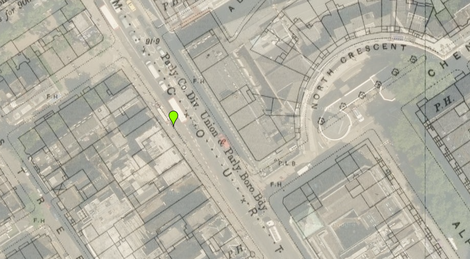
I began my research by taking screenshots of Tottenham Court Road in Victorian Google Maps. Below is Tottenham Court Road during the both Victorian Era and the present day (“London”).
 “British Histories” offered me the most information. At the top of the page is a search bar in which I entered my street name. The search resulted in plethora of publications concerning Tottenham Court Road. The excerpt that I found most valuable on this website revealed that 1878 marked a turn in the lives of many people in London. The author explains that in 1878, poverty was spreading on Tottenham Court Road in Rathbone Place. Walford describes it, “where poverty is almost hopeless” (“Quick”). This helps to explain the violence that Peterson encountered that night he was heading home on Tottenham Court Road. Because of widespread poverty in the area, the men likely attacked James Ryder because they were hungry wanted to eat his goose (and take the blue carbuncle!).
Another site that I found useful in researching Tottenham Court Road was “Old Bailey Online.” It was easy to search for criminal records near or on Tottenham Court Road. The search page allowed me to adjust the time period as well. I searched for records between 1800 and 1901. Almost all of the records from Tottenham Court Road and nearby areas documented theft crimes. Most of them were grand larceny, some of them highway robbery, and a few of them theft from a specified place. One of the records, for example showed that Sarah Crosby stole a shirt, and seven stockings (“The Proceedings”). After viewing the records, I reviewed the situation from The Adventure of the Blue Carbuncle during which the men are attempting to take James Ryder’s goose. With my new knowledge of theft crime on Tottenham Court Road, I realized that it wasn’t uncommon for such situations to occur.
The sites that I found least useful were “Historical Eye,” “Locating London,” and “Charles Booth’s Online Archive.” I was unable to search on “Historical Eye.” On top of that, reading through the site proved to be ineffective because it lacked any information on Tottenham Court Road. “Locating London” turned up only four results even after searching various forms of the street name in 1800 (Ex. Tottenham, Tottenham Ct. Tottenham Court Road). As it turned out, each result led me to the same exact record. The record had nothing to do with Tottenham Court Road, in fact, it only appeared in my search results because the word “Tottenham” appeared on the record once without any context (“Home”). Link to this record: http://www.londonlives.org/browse.jsp?div=NAHOCR70004CR700040070. After an hour of trying to find Tottenham Court Road on the “Charles Booth’s Online Archive” by switching back and forth from Victorian Google Maps to Booth’s map, I still could not locate it. This is unfortunate because Booth’s archive would have been useful for my research considering that it maps poverty.
[Edit Nov. 10th: I now know that there is a search bar on Charles booths online archive. I searched my street name and the following picture of my street revealed that in 1898-99, residents of were living fairly comfortably.]


Altogether, Victorian Google Maps, “British Histories,” and “Old Bailey Online” were helpful in learning about Tottenham Court Road, but the other GIS maps were difficult to navigate even after reviewing how to use some of them in class.
Works Cited:
“Booth Poverty Map & Modern Map (Charles Booth Online Archive).”Booth Poverty Map & Modern Map (Charles Booth Online Archive). N.p., n.d. Web. 07 Nov. 2014.
“Circa 1896: Reinventing the Wheel.” Historicaleye.com. N.p., n.d. Web. 07 Nov. 2014.
“Home | LOCATING LONDON’S PAST.” Home | LOCATING LONDON’S PAST. N.p., n.d. Web. 07 Nov. 2014.
“London – OS Town Plan 1893-6.” London – OS Town Plan 1893-6. N.p., n.d. Web. 07 Nov. 2014.
“The Proceedings of the Old Bailey.” London History. N.p., n.d. Web. 07 Nov. 2014.
“Quick Introduction || Pause.” British History Online. N.p., n.d. Web. 07 Nov. 2014.