Here is our final project on banned books!
By Devon Hauser, Rachel Janowsky, Danielle Koppie, and Emma Tomicic
Here is our final project on banned books!
By Devon Hauser, Rachel Janowsky, Danielle Koppie, and Emma Tomicic
By Beth Wynne, Miranda Delancey, Devon Hauser, Jenna Corti, Danielle Koppie, Veronica Verstraten, and Rachel Janowsky.
Threadneedle Street is mentioned in The Man with the Twisted Lip, where Neville St. Clair, disguised as Hugh Boone, performs his beggary. Boone sits, “Some little distance down Threadneedle Street, upon the left-hand side,” just outside the opium den (Doyle 5). This is where Mrs. St. Clair spots her husband flailing from a window. Before this interruption she walks skeptically, “glancing about in the hope of seeing a cab, as she did not like the neighbourhood in which she found herself” (Doyle 4). The story gives the impression that this was an impoverish and faulty area.
A historical account of Threadneedle St. recalls the area was occupied by “cripples on go-carts who haunted the neighbourhood” (Thornbury, “Threadneedle Street”). This alludes to Doyle’s story quite well considering St. Clair portrayed Boone as a cripple.
Taken from the “Charles Booth Online Archive,” the area surrounding Threadneedle Street was classified as poor. (See Poverty Classification Key.)
It’s hard to see clearly, but the street is located mid photo, above St. Michael. View the “Booth Archive” page, here.
 Here’s a better glimpse of Threadneedle Street from 2000.

The crime and poverty as described in The Twisted Lip and the Poverty Classification (Booth Archive) of Threadneedle St. correspond well.
So, how much crime actually surrounded Threadneedle Street based off of the story in The Twisted Lip? Using “Old Bailey Online,” I was able to find multiple accounts of grand larceny, murder and theft in the Threadneedle St. area. From the Conviction of Henry Harrison, Mr. Harrison, escaped prisoner, hid for sometime in the home of a Mr. Garway. As it is mentioned, “He takes a Lodging at Mr. Garway’s in Threadneedle-street, on the twenty third day of December, and there he continued till about the first of January” (“Henry Harrison, Killing”). Mr. Harrison was a convicted murderer. Pretty profound!
A particular case involved several pieces of stolen clothing by a man named Joseph Johnson, carrying “the Goods of William Savage” from London’s Lombard Street to Threadneedle Street (“Joseph Johnson, Theft”). Other cases involved pickpocketing, and violent encounters. A constable was charged with Edward Lynch, where on “Threadneedle street, [the prisoner] drew a knife upon the prosecutor” and made attempts at the constable as well (“EDWARD LYNCH, Theft”).
Charles Rice, who had stolen innumerable goods, was spotted on Threadneedle Street. Once, by a man named Thomas Edwards who “was coming up Threadneedle-street, when [Rice] was in custody,” and another time by Alexander Barland who saw [Rice] heading towards the “Edinborough coffee-house” (“CHARLES RICE, Theft”).
Edinborough wasn’t the only coffee-house mentioned near Threadneedle St. From “British Histories” I learned of the “North and South American Coffee House (formerly situated in Threadneedle Street)” (Thornbury, “Threadneedle Street”). There was also the Baltic Coffee House, where merchants and brokers occupied their time. It was described as a “rendezvous of tallow, oil, hemp, and seed merchants” (Thornbury, “Threadneedle Street”).
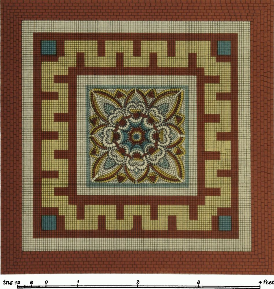
Threadneedle was also the site of the French Protestant Church where red pavement lined the streets. The findings of pavement are rather remarkable and exceptionally crafted (Thornbury, “Threadneedle Street”). It goes to show that Threadneedle St. was not solely defined by theft and poverty but the site of pleasant coffee-houses and decorated pavement.
The Threadneedle Street Pavements:

Works Cited
“Joseph Johnson, Theft, October 1720 (t17201012-3).” Old Bailey Proceedings Online. Web. 6 November 2015. <http://www.oldbaileyonline.org/browse.jsp?id=t17201012-3-defend38&div=t17201012-3#highlight>
“Henry Harrison, Killing, April 1692 (t16920406-1).” Old Bailey Proceedings Online. Web. 7 November 2015. <http://www.oldbaileyonline.org/browse.jsp?id=t16920406-1&div=t16920406-1&terms=+threadneedle%20+street%20#highlight>
“CHARLES RICE, Theft, September 1785 (t17850914-125).” Old Bailey Proceedings Online. Web. 7 November 2015. <http://www.oldbaileyonline.org/browse.jsp?id=t17850914-125&div=t17850914-125&terms=+threadneedle%20+street%20#highlight>
“EDWARD LYNCH, Theft, September 1776 (t17760911-34).” Old Bailey Proceedings Online. Web. 7 November 2015. <http://www.oldbaileyonline.org/browse.jsp?id=t17760911-34&div=t17760911-34&terms=+threadneedle%20+street%20#highlight>
Thornbury, Walter. “Threadneedle Street.” Old and New London: Volume 1. London: Cassell, Petter & Galpin, 1878. 531-544. British History Online. Web. 7 November 2015. <http://www.british-history.ac.uk/old-new-london/vol1/pp531-544>
“Plate 50: Threadneedle Street, Pavements.” An Inventory of the Historical Monuments in London, Volume 3, Roman London. London: His Majesty’s Stationery Office, 1928. 50. British History Online. Web. 5 November 2015. <http://www.british-history.ac.uk/rchme/london/vol3/plate-50>
In “The Man With the Twisted Lip,” London Road is briefly mentioned as Sherlock and Watson begin their dash to finally solve the mystery of Mr. Neville St. Clair’s disappearance. Upon further research, I learned some interesting facts about the road that had little significance in the actual Sherlock Holmes story. Unfortunately, there are over twenty roads called “London Road,” just in the city of London, alone! So many of the facts that I saw were not entirely accurate due to the inability to distinguish between multiple roads. Since many of the websites are not specifically based around Victorian London, it was more difficult to find the correct road.
By using the Old Bailey Proceedings through Locating London, I was able to find that there were not many crimes committed on the road, but of the ten crimes that came up in the search results, five of them were highway robberies, and three involved animal theft. The first result was of a man names James Coates, who viciously stole a diamond ring from Mrs. Elizabeth Atley. He was sentenced to death for this crime (“James Coates, highway robbery”). I also learned that the London Road in Ipswich, not in London, is apparently site of the flat of Steve Wright, who murdered five women in 2006, an event about which a movie and a musical were written (both called London Road).
While looking at the OS Town Plan of Victorian London, I can tell that London Road has not changed much, and is still a major road in the city. Much of the information about London Road on British Histories contained information about religion. It was interesting because several of the articles were about religions that do not dominate London, such as Judaism and Islam. There are also many bits of information about monuments and buildings on the road.


The Charles Booth website offered the most useful and accurate information, despite having the worst design of any of sites. The website shows a map of London and color codes each street based on economic class. It shows London Road in pink, which means that the average economic state of people on London Road back in Victorian London was “Fairly comfortable.”

Works Cited
Doyle, Arthur Conan. London: Strand, 1891. Short Stories: The Man With The Twisted Lip by Arthur Conan Doyle. East of the Web. Web. 6 Nov. 2015. <http://www.eastoftheweb.com/short-stories/UBooks/TwisLip.shtml>.
“Search.” British Histories. University of London, n.d. Web. 6 Nov. 2015. <http://www.british-history.ac.uk/search?query=%22London+Road%22>.
“Booth Poverty Map & Modern Map (Charles Booth Online Archive).”Booth Poverty Map & Modern Map (Charles Booth Online Archive). London School of Economics and Political Science, n.d. Web. 6 Nov. 2015. <http://booth.lse.ac.uk/cgi-bin/do.pl? sub=view_booth_and_barth&args=531720%2C179260%2C1%2Clarge%2C0>.
“James Coates, highway robbery. 15 January 1702 (t17070115-7).” Old Bailey Proceedings Online. Web. 6 November 2015. http://www.oldbaileyonline.org/browse.jsp?id=t17070115- 7&div=t17070115-7&terms=+London%20+Road%20#highlight
Hi, my topic is different types of dogs!
Card layout:


I included 10 different breeds of dogs and my categories were name of animal, location of origin, country of origin, average life span, image, and size. To see this information you can checkout my google spreadsheet, the link is below!
Spreadsheet: https://docs.google.com/spreadsheets/d/1S-CHkqY1X-iTKZ5NzsDy-VD3nAtCK4EmTxnrqjCpvxE/edit?usp=sharing
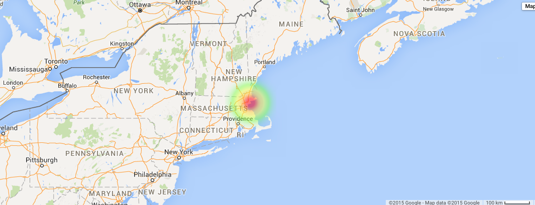
Map:

This map corresponds to the location of origin of each dog. There are not 10 individual circles because many dogs came from the United Kingdom and Germany, therefore the dots are clustered together to look like only one.
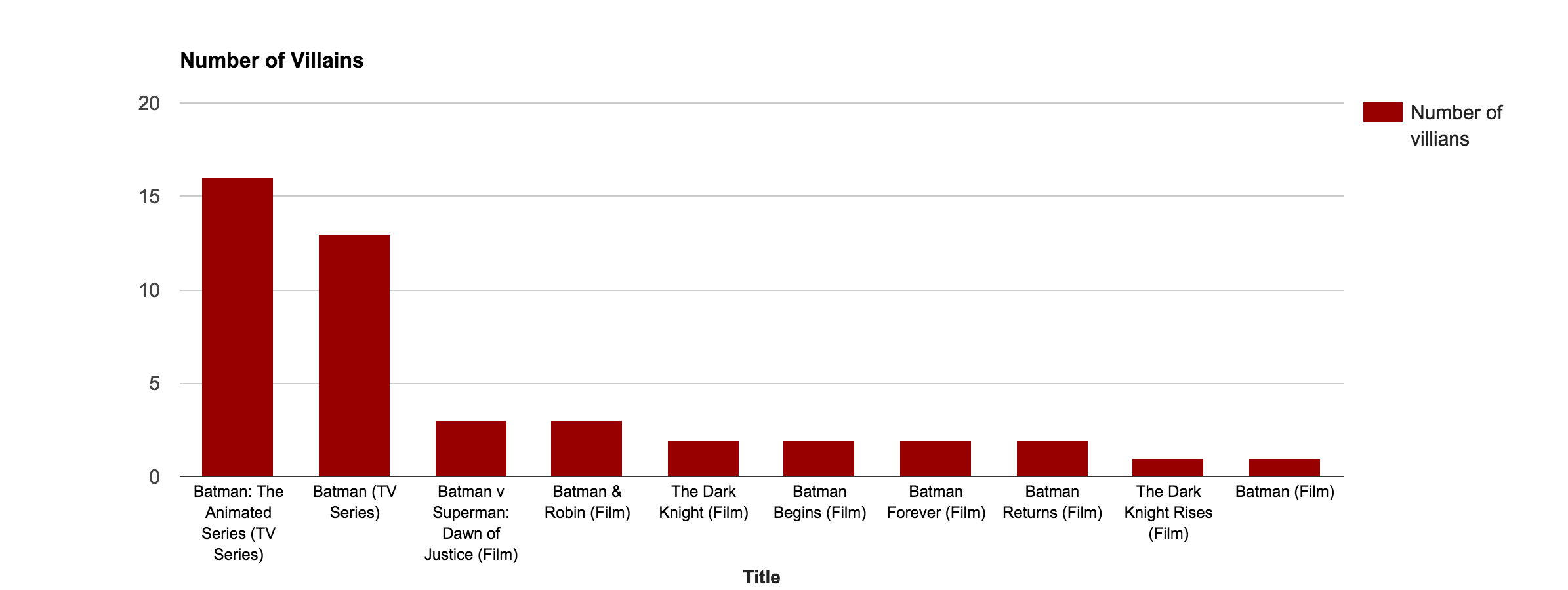
Bar Graph:

This bar graph is comparing the average life span of different types of dogs. Yorkshire terrier’s have the highest mortality rate while Bull dogs have the lowest.
Pie Chart:

In my pie chart I compared the different sizes of the 10 breeds of dogs I chose.
Network Visualizations Graph:

In this graph I decided to use country of origin because many dogs originate in the same location. For example, the United Kingdom is where Bulldogs, Golden Retrievers, American Pitbull Terirer’s, and Yorkshire Terrier’s originated. A network visualization graph allows this information to be clearly communicated seamlessly to the viewer.
To check out this information on the google fusion tables website click the link below:
https://www.google.com/fusiontables/DataSource?docid=1Vr1K-5MTAt7W1Jim-lCHobopXXlYcehI4rH7y8eW
https://www.google.com/fusiontables/DataSource?docid=1jNGQNPrwU-j8oWzP-gU5fKlYIC9CWThhZDruIx29
Google Spreadsheet Info


Cards


map locations of videos

Pie graph

Bar graph

Donut graph

Here’s a link to my Google Fusion Table
Default Cards


Network Visualization
This shows the connection between artist and genre weighting them by how many albums I have in my iTunes library, showing what genres are most influential to me. (I don’t know why the one bubble in Rock doesn’t label Kings of Leon as the artist).

Maps
Weighted by Number of Albums (in my iTunes)

Weighted by Number of Awards

Pie Chart
(Continued because the list of artists didn’t fit the page)


Bar Chart

Here is the link to my Google Spread Sheet
https://docs.google.com/spreadsheets/d/18DOsbu9mAvl-Yusy7TZV1y2VebSUjC7lUOHiVjne1DA/edit#gid=0 Also a screenshot

Default Card


Bar Graph

Pie Chart

Network

Here are the different parts of my project!
Cards:

Map of various filming locations from movie adaptations:

Pie Chart:

Bar Graph:

Network Visualization: