Mapping Holmes: Waterloo Station

For my mapping project, I decided to focus on The Adventure of the Speckled Band. The story doesn’t prominently feature many locations in London–in fact, there are pretty much only two that are real. That being said, I chose too look into the location of Waterloo.

mapping holmes 1

mapping holmes 2

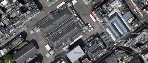
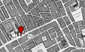
I specifically searched for Waterloo Station on Victorian Google Maps, as the three mentions of the location in the story are all references to travel. Geographically, the station is located in close proximity to the River Thames, with several factories and a timber yard wedged between the two.

mapping holmes 3

Upon searching for “Waterloo” on the Old Bailey Online archive, I found that the vast majority of crime involved theft, from pickpocketing to grand larceny. Within the first 30 results, the only other crimes mentioned are one case of murder and two cases of coining offenses. In the description of the crime for the murder case, Water is only mentioned in that the comrades of the deceased had intended to celebrate the anniversary of the battle of Waterloo.

mapping holmes 4

The economic classes of the areas surrounding the station were highly varied. Given that there seemed to be businesses in the area, it makes sense that they would fall in the pinkish-red range. Still, there is a significant portion of the map in light blue, suggesting a poorer population.

mapping holmes 5

Despite the appearance of moderate wealth in the businesses, according to the entry about Waterloo Road on British History Online, the business district seemed to be mostly confined to “bonnet-shapes, playbills, and pale dry cigars.” The houses along the road were all extended through series of cellars, “the lowest of which no eye may fathom,” due to the height of the road as it neared the bridge.

One of the notes following the story as published in The Strand reads, “Waterloo Station serves the south and southwest rail corridor from London. Miss Stoner must have taken a cab across the Thames for four miles to reach Baker Street from Waterloo.” Throughout The Speckled Band, Waterloo is referred to as a sort of waypoint. The rail station is traversed by Ms. Stoner, Sherlock, and Watson, and it is never suggested that they remain there for any length of time. As far as its presence in Doyle’s story, it is not a place to stay – it is simply a place to move through.

What’s Up with Oxford Street?

Oxford Street is quickly mentioned in “The Blue Carbuncle” when Holmes and Watson are rushing to the Alpha Inn in Bloomsbury. At the inn Holmes questions the landlord about where he got his geese from. The landlord then informs them they that the geese were purchased from Mr. Breckenridge in Covent Garden; a market that still exists today. A quick Google search of “Bloomsbury Alpha Inn” revealed that the Alpha Inn was most likely based on a tavern that is still in service today. The Museum Tavern is a small pub that according to Google Maps has “[c]ask ale, global wines and pub grub in a Victorian interior with carved wood and etched glass.” A quick scan of Google Maps showed that Museum Tavern is directly down Oxford Street fitting perfectly with the storyline and the assumption that the Museum Tavern and the Alpha Inn are on in the same. Oxford Street today is a bustling road filled with numerous shops in the city Westminster. It is said to be one of London’s most active and lively shopping streets. This makes a great deal of sense since according to the “Charles Booth Online Archive” Oxford Street passes through almost exclusively middle to upper class living. Oxford Street also passes through Oxford Circus, an intersection between Oxford Street and Regent Street. An interesting observation came about when I was looking at the London town plan map on Google that shows an extensive map of London from the late 19th century. While looking for Oxford Circus I realized it used to be called Regent Circus. A Wikipedia search only provided that it was constructed in the 19th century and a more extensive search didn’t uncover much about why they renamed it. Overall, Oxford Street wasn’t quit of paramount importance to Holmes and Watson. It merely provided a straight stretch to the Alpha Inn.

Screen Shot 2015-04-09 at 10.21.43 PM


Screen Shot 2015-04-09 at 10.22.01 PM


Screen Shot 2015-04-09 at 10.22.43 PM

Covent Garden Markets. Shack Burger not included.

In the Holme’s short story, “The Blue Carbuncle,” the Covent Garden Market in London is visited in the story.  Here, Holmes talks to a goose salesman named Breckenridge who sold the goose that had the carbuncle in its crop.

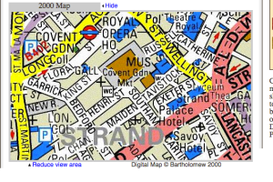
The Covent Garden Market is farmer’s market and shopping center located in the center of the Covent Garden District of London which is a very popular shopping and tourist destination.

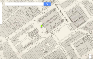
Here is what the Market looked like in 1896.

Screen Shot 2015-04-09 at 4.56.42 PM


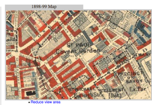
In the story, the area Watson and Holmes have traveled to the market, has been described as a slum. According to the Booth Poverty map, most of the area around the market is middle class, especially right near the market, though there are some light and even darker blues the further you get away from the market.  These people may have ran into the markets and stole food if they could not afford to feed their families adequately.

Screen Shot 2015-04-09 at 5.10.02 PM

Screen Shot 2015-04-09 at 5.10.25 PM

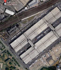
One very interesting fact that I have learned from British-History.co.uk is that there has been a period where many people wanted the market to change its location mainly due to congestion from a boom in production of produce.  In the 1960s, an increase in traffic to the area has caused major problems around the area.  So the “original” market is not here anymore.  It has actually has moved to a different location in Southwest London (in Nine Elms).  The location (called the New Covent Garden Market) is much more convenient for modern London, as there is a large parking garage that is able to accommodate many vehicles as well as a delivery trucks unloading to the store.

Ca1pture
It ain’t no Wegmans.

Today, the original site is now a large shopping center complete with pubs, cafes and small stores.  This makes Covent Garden more akin to Times Square as many people come here. Covent Garden does have one major advantage though, it is indoors! So rain won’t stop you.

I thought it was interesting to learn that a small plot point in The Blue Carbuncle can be full of rich history.  This is just another part of London’s charm that is why many people want to visit this city.

Capture
They even have Shake Shack here!


Tottenham Court Road

My designated area to study was Tottenham Court Road, which is briefly referred to in “A Case of Identity.”

Tottenham Court Road Currently
Tottenham Court Road, modern view
Tottenham Court Road, Victorian view

According to the Charles Booth Archive map, Tottenham Court Road itself was mostly red/middle class, or well to do. The surrounding areas contain mostly pink, purple, and dark blue: “fairly comfortable, good ordinary earnings”,”some comfortable,others poor”, and “very poor.” Nearby Bedford Square is colored yellow, signifying an upper class area.

DHM Booth Pic

Booth’s journal notes from walks with Constables around District 3 (which included Tottenham Court Road) in 1898 include descriptions of prostitutes, drunkenness, crime, and broken windows. These descriptions seem to match Booth’s harsh judgements under the “dark blue” poverty category on the map that surrounded Tottenham Court Road. A brief search on The Old Bailey database (starting in 1881 when the story was published) revealed crime clustering around theft. Continue reading

Wimpole Street

Wimpole Street I used the area of Wimpole Street from the Adventure of the Blue Carbuncle.


Wimpole Street 1800Using the Charles Booth Online Archive I  was able to find my street and see how the area around it was wealth wise. You can see by the yellow on the right side of the street it is an Upper-Middle and Upper class area. The people who lived in this area were wealthy and respected. On the right side of the map the area is mainly Middle-Class people who were well to do. The divide is pretty clear but the classes are pretty close so I do not believe it would create a large conflict. There is one small area that is light blue meaning it is a poor area. This could create conflict and devalue the houses around the area. It could possibly be a small ghetto or maybe even a shelter of some sort. I also got information for the Old Bailey website, I was able to see about the crime that took place in the area. I was rather surprised by the crime since was a wealthy area. I thought that there would be less crime because of this but there are several cases of grand larceny. All the thefts could be due to the area being wealthy, they had more money to spend on nicer objects and others may want to still those. The small area of poorer people could also account for the crime, this is not to say that being who are poor are more likely to steal but they could be without certain objects that those in the richer area have.

Wimpole Crime

Overall, I was not surprised to see that the area was more upper and middle class people because Sherlock himself is of middle-class so he would associate with people of similar class levels.

Cruisin’ Regent Street

Screen Shot 2015-04-09 at 2.14.49 PM
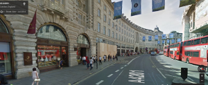
Regent Street today, specifically the curved part heading towards Piccadilly Circus

I was tasked with looking into Regent Street in London, which is mentioned in A Scandal in Bohemia. Here is the passage from the story that mentions Regent Street, and it entails Holmes describing Irene Adlers’ future husband:

 “He was in the house about half an hour, and I could catch glimpses of him in the windows of the sitting-room, pacing up and down, talking excitedly, and waving his arms. Of her I could see nothing. Presently he emerged, looking even more flurried than before. As he stepped up to the cab, he pulled a gold watch from his pocket and looked at it earnestly, ‘Drive like the devil,’ he shouted, ‘first to Gross & Hankey’s in Regent Street, and then to the Church of St. Monica in the Edgeware Road. Half a guinea if you do it in twenty minutes!’

According to the Conan Doyle Encyclopedia, Gross & Hankey’s was probably a jewelry shop, although it was fictitious. Mr. Norton hurried there before going to the church to secure the wedding bands. After researching the Regent Street area, I focused on the section of the street that curves, heading into Piccadilly Circus. Today, this is a very upscale shopping district, and there is an Underground station at Piccadilly Circus. (Note: In this context, a circus, from the Latin word meaning “circle”, is a round open space at a street junction)

Screen Shot 2015-04-08 at 4.03.15 PM
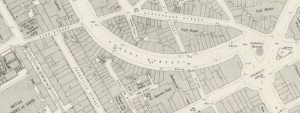
Victorian Google Map of the Regent Street and Piccadilly Circus area
Screen Shot 2015-04-08 at 4.04.20 PM
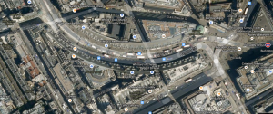
Current Google Map of Regent Street leading into Piccadilly Circus. Note several upscale shops on Regent in this area today.
Screen Shot 2015-04-09 at 1.07.30 PM
Using http://www.locatinglondon.org, a 1746 map shows Piccadilly, but Regent Street doesn’t exist yet. “The Hay Market” on the right corresponds to the lower part of the future Regent Street.

Although the jewelry shop was fictional, Booths’ map shows red and yellow which indicate the upper end of income. It can be established that the Regent Street/Piccadilly Circus area has been wealthy for over a century, at least.

Screen Shot 2015-04-08 at 4.10.28 PM
Charles Booth Map of Regent by Piccadilly Circus

Finally, British History Online provides an even deeper glimpse into the history of Regent Street. This website reinforced the facts that I already knew; the commercial aspects and the wealth of the area were well established. However, I also discovered when Regent Street was designed and built (1813), why it was named as it was, and the architect behind the buildings (John Nash).

The long vista of Regent Street, as seen from the Quadrant, is very fine, exhibiting, as it does, a remarkable variety of architectural features. It was erected principally from the designs of Mr. John Nash, who deserves to be remembered as the author of this great metropolitan improvement; and it was named from the architect’s patron, the PrinceRegent. The expenditure of the Office of Woods and Forests in its construction was a little in excess of a million and a half. Of course, being a thoroughfare of so recent a date, having been commenced in 1813, Regent Street has scarcely a back history for us to record here, like Pall Mall and St. James’s Street. It belongs to “new,” and not to “old” London.

In his design for Regent Street, Nash adopted the idea of uniting several dwellings into a façade, so as to preserve a degree of continuity essential to architectural importance; and it cannot be denied that he has produced a varied succession of architectural scenery, the effect of which is picturesque and imposing, superior to that of any other portion of the then existing metropolis, and far preferable to the naked brick walls at that time universally forming the sides of our streets.

Edgware Road

Screen Shot 2015-04-07 at 8.45.47 PM

Screen Shot 2015-04-07 at 8.48.02 PM

In “A Scandal in Bohemia,” Sir Arthur Conan Doyle briefly refers to Edgware Road in regards to the Church of St. Monica where Irene Adler marries Godfrey Norton.  Based on the Wikipedia article, “Edgware Road is a major road through north-west London, starting at Marble Arch in the City of Westminster (south end) and running north-west to Edgware in the London Borough of Barnet.”

Screen Shot 2015-04-08 at 2.16.50 PM

The first source that I used in order to learn more about this area was the “Charles Booth Online Archive” in order to view what the economic status was like during the time that the Sherlock Holmes stories were written.  Based on this archive, I discovered that in this particular area the colors that are present on the map are mainly red and yellow.  Based on the legend of the Charles Booth Online Archive, the red represents the middle class and well-to-do people and the yellow represents the upper-classes and very wealthy.  This particular detail about the area correlates with “A Scandal in Bohemia” because Irene Adler is a well-known American opera singer and in the story, she is going to marry a very well-to-do lawyer named Godfrey Norton, therefore, Sir Arthur Conan Doyle chooses this place from the London area in order to really show what Edgware Road was like because Church of St. Monica is a very elegant church.

The second source that I used to learn more about this area was “Locating London’s Past” in order to view how much criminal activity was occurring in this particular area of London when the Sherlock Holmes stories were written. Based on “Locating London’s Past,” between 1800-1819 there were 21 instances of criminal activity on Edgware Road; 21 is a relatively low number.  Therefore, this particular detail about the area relates to “A Scandal in Bohemia” because when Irene Adler, Godfrey Norton, and Sherlock Holmes are on Edgware Road, it is not because a crime was committed, but rather for a wedding.  Moreover, this further emphasizes the daily activity that took place on this particular road, one of which was not much crime.

The third source that I used to learn more about Edgware Road was “The Historical Eye” in order to view what was located in that area when the Sherlock Holmes stories were written.  According to “The Historical Eye”,  the Marble Arch stood in front of the entrance leading to Buckingham Palace, “bearing the Royal banner of England.”  Moreover, the Marble Arch is a very important landmark near Edgware Road.  Therefore, this particular detail correlates to Edgware Road in “A Scandal in Bohemia” because the Marble Arch is a very important and ravishing landmark which shows the wealth of the area and it is understandable why Irene Adler and Godfrey Norton get married at the church on Edgware Road because they are wealthy and they want to have a perfect and prosperous setting.  Below is a screenshot of the Marble Arch circa 1896 from “The Historical Eye”.

Screen Shot 2015-04-08 at 11.31.30 PM

Mapping Holmes Project by Kristen Warfield

The street that I chose for my mapping project was Brixton Road from “The Adventure of the Blue Carbuncle.”

As we had read in class, the basis of this story investigates the theft of a jewel, a “blue carbuncle.” Holmes and Watson find the missing jewel due to an honest gentleman that realizes it was hidden in the neck of a goose he was going to make for dinner. Our detectives then went out to find the source of the goose, which they figured out were supplied by a woman named Mrs. Oakshott – a resident of Brixton Road in London!

Here’s a screenshot from the Victorian Google Map of my location (right).

Screen Shot 2015-04-07 at 8.43.59 PM

To learn about the past crimes involving this road, I set off to the Old Bailey archive of London’s Central Criminal Court. I really liked using this database because it provides an in-depth look into public documents of the past.

There were 10 entries involving Brixton Road, mostly involving grand larceny, theft and burglary – but I did come across two rather peculiar findings… two instances of animal theft! Upon looking into these cases more, one particular case of a shepherd stealing someone’s sheep and butchering them lead me to believe that this could possibly be a source of inspiration to the story due to the seemingly rural nature of the area.

In the story, the man who had the jewel (Ryder) had traveled to his sister (Mrs. Oakshott)’s house on Brixton Road to “pick out his Christmas goose.” He picked a goose and shoved the jewel down it’s throat, both relating the case of animal theft found in the Old Bailey archive – he put an item of theft, essentially, into an animal! By learning of the past crime documented in the area, the fictional occurence in the Holmes story does not seem out of character at all for the road.

Now onto another aspect of my research: Charles Booth’s Poverty Map. By plugging in Brixton Road, I learned that the road proper was generally a middle class, “well-to-do” population. However, when we look at the upper left of my screenshot of the data, we see that there is a small region that is indeed classified as “very poor” and “poor.”

Brixton Road is the large road on the right hand side of the image encased in red coloring.

I thought that it was rather interesting for such a huge gap in income over what essentially is just a block worth of space. I continued to do some further research to figure out why this may be on British History Online.

According to this database, a various number of estates resided on Brixton Road : most of which were parcels of land or homes inherited from other seemingly wealthy family members. I chose to investigate even further by reading an entry about a specific family’s role in the development of the road.

The Angell Estate had been passed down through family members since the near 17th century on and some family members inherited acres upon acres of land on Brixton Road. From reviewing the materials, I learned that this land later included areas for farming.

Though farmers are wrongly stereotyped as not the wealthiest of individuals, it may very well be possible that the industry that brought this area it’s status of wealth was in fact farming. Based off of the evidence that I have found about the amount of estates on this road, I can conclude that this was somewhat of a small plantation area, and the small portion of the “poor-very poor” classification area next to the road could possibly be where some of less-wealthy workers of these estates or plantations lived.

Sources:
Charles Booth Online Archive (http://booth.lse.ac.uk/, 08 April 2015) 1898-99 Map, search:”Brixton Road.”
Old Bailey Proceedings Online (www.oldbaileyonline.org, version 7.2, 08 April 2015), October 1807, trial of JOHN KING , alias BENJAMIN GIBBS
‘Brixton: The Angell estate.’ Survey of London: Volume 26, Lambeth: Southern Area. Ed. F H W Sheppard. London: London County Council, 1956. 125-131. British History Online. Web. 2 April 2015.

Mapping Holmes

For this assignment, I decided to focus on Fenchurch Street, a location that was mentioned in the Sherlock Holmes story A Case Of Identity. In the story, Fenchurch Street is the location of Miss Sutherland’s step-father’s place of business. Located just around the block from here is Miss Sutherland’s fiancee’s home on Leadenhall Street, which (SPOILER ALERT) turns out to be Miss Sutherland’s step-father. You can see a picture of Fenchurch Street on a map I got from Victorian Google Maps below:

Screen shot 2015-04-07 at 7.23.48 PM

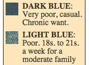
When I looked at the Charles Booth Online Archive, I found out that during the 19th century Fenchurch Street was a very poor area, as you can see on the map and color guide below. The black and blues show that people of the lowest classes lived in this area. This relates back to the Holmes story because Mr. Windibank, Miss Sutherland’s step-father, tried to pose as another man to make Miss Sutherland fall in love with him so he could eventually marry her and take all her money. Mr. Windibank’s place of business was also located just around the block from Fenchurch Street on Leadenhall Street. This area was a good location for Arthur Conan Doyle to put both of Mr. Windibank’s identities in because it shows that he has very little money. If he lived and worked in a different area it wouldn’t make as much sense to the story.

Screen shot 2015-04-07 at 8.02.32 PMScreen shot 2015-04-07 at 8.02.48 PM

On the Old Bailey Archive, I did a search on my location and found a list of the crimes committed throughout the 19th century. Most of these crimes listed were for all things theft related, like grand larceny, shoplifting, pickpocketing, and even a couple of theft related murders. When I looked at the Locating London website, I found similar results. Then I decided to look at the British History Online website. When I searched my location on there, I found many texts involving businesses and factories, where I learned that this area held many businesses and industries and probably had many jobs that people of the working class had. I’m not saying that poor people were more likely to be criminals, but in order to survive and support their families people of the lower classes needed to do what they could, and theft was probably a last resort option for them to get necessities.

DeFranco_Mapping Holmes Assignment

I chose to focus on Leadenhall Street from the Sherlock Holmes story, A Case of Identity for this mapping/research assignment. This image is screen-shotted from the Victorian Google Maps website. Leadenhall Street is the thick, long street running horizontal through the image.

Screen shot 2015-04-07 at 3.37.50 PM

On the Old Bailey Archive I did a search of Leadenhall Street in the 1800s and found man phrases that much of what came up seemed business related, as if Leadenhall was a bustling, though not incredibly wealthy, business district with many places of employment and local businesses. Here are some examples of what I found that lead me to make this conclusion:

-“…I am a clerk at the post office, 114, Leadenhall Street…”
-“…Holder Brothers, Ship brokers, 146, Leadenhall Street…”
-“…he was an advertising agent in Leadenhall Street…”
-“…I am a printer, of 18, Leadenhall Market…”
-“…I am a tea importer, of 158, Leadenhall Street…” etc.

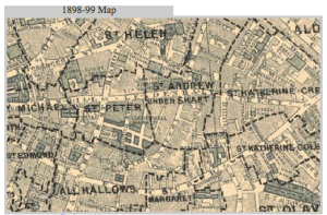
On the Charles Booth Online Archive I searched for the Street and came up with the following 1898-99 map.

Screen shot 2015-04-07 at 4.05.38 PM Screen shot 2015-04-07 at 4.06.23 PM

According to the legend, the coloring of the map showing the surrounding areas of Leadenhall Street indicate that this was not a wealthy area. It seems that most of this area (the light blue range) is poor and some (the dark blue) indicates very poor areas. I can’t really tell if there are actually dark blue areas or if it’s just light blues layered on top of each other making certain spots look darker. Anyway, from this information and what I previously discovered about the many businesses along Leadenhall Street, it seems that it was a very working class area where people just barely managed to scrape buy and support their families and provide the necessities. Maybe there aren’t quite and “very poor” dark blue areas because there are lots of small local jobs in the area so people are not in the range of “chronic want.”

On the Locating London website, I did a search of Leadenhall Street to discover what typed of crime were reported in this area in the early 1800s. What I found were that all of the offenses were related to theft: pickpocketing, grand larceny, coining offenses, theft from a specified place, shoplifting, highway robbery, etc. I supposed this makes sense if the area was full of businesses and people just barely making it by. I’m not associating the poor with the crime, but these people were, in some way, wanting (indicated by the map showing wealth), and this could lead to theft.