Overview of my research key words in wordle form:
PONDING – Ponds vastly outnumber larger lakes worldwide, yet we understand little about pond chemistry, biology, and physics relative to lakes. We have started a multi-faceted project called PONDING: Pond Observation aNd Discovery in GLEON. GLEON is the Global Lake Ecological Observatory Network. The aim of this project is to study the ecological and physical parameters of ponds to evaluate what (if anything) makes them different from lakes. We have several projects running including asking “What is a pond?“, understanding temperature and mixing in ponds, pond metabolism including primary production and respiration, and greenhouse gas emissions from ponds.

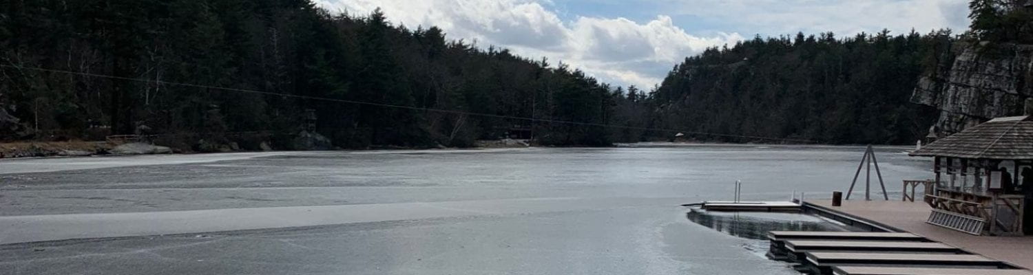
Lake Minnewaska and other sky lakes– Lake Minnewaska is one of five sky lakes that run along the Shawangunk Ridge in Ulster County, New York. A fishless ecosystem for nearly a century, Lake Minnewaska had developed a unique ecology due to its outstanding clarity. For example, Lake Minnewaska is home to a water moss observed deep in the lake and constitutes the majority of the vegetative carpets on the lake bottoms. Also, the fishless, acidic Lake Minnewaska is a suitable environment in which Two-Lined salamanders (Eurycea bislineata) could breed without fear of predation and the salamander have been observed for over 20+ years. In late 2008, early 2009, small bait fish (Golden Shiner minnow or Notemigonus crysoleucas) between 2 and 10 cm have been frequently observed near the shore of Lake Minnewaska since their introduction via recreational users. In this historically clear water (oligotrophic) lake, several broad scale changes have occurred since the minnow’s introduction. Water clarity has decreased and more algal blooms have turned the lake green. We are trying to understand the changes to the lake and evaluate the potential for minnow removal.
Temperature Sentinels NENA: In Depth Study of Lake Thermal Responses and Teleconnections in Northeastern North America – In the northeastern North American (NENA) lakes project, we will examine subsurface temperature profiles across the NENA region to examine how lake temperature profiles respond to regionally consistent climatic changes and teleconnections. We will examine a set of focal NENA lakes with long-term, high resolution temperature profile data and a larger set of NENA lakes with temperature profiles from a single annual profile. We plan to address the following research questions: 1) What do we gain, if anything, from higher resolution data than just 1 profile per summer? 2) How has lake stratification phenology and stability changed over time with climate change? 3) Are lakes of a given depth, size and transparency more effective sentinels of climate change? Do you see stronger/weaker signals in large, clear deep-water lakes? 4) Does distance from coast affect the strength of teleconnections (such as NAO and El Nino/La Nina) on lake thermal structure? To read more about this project which is link to Global Lakes Ecological Observatory Network (GLEON) and to see the list of collaborators, click here.
Lake Metabolism – Ecologist use different measurements to describe the dynamics of ecosystems. We use structural measurements like temperature, chlorophyll a concentration, or dissolved oxygen. These represent snapshots of the ecosystem at a time. On the other hand, functional measurements such as respiration, photosynthesis, and other metrics of ecosystem metabolism represent active processes and can be sensitive to environmental change. I am working with several collaborators on projects looking at functional metrics in aquatic ecosystems (e.g. streams, rivers, lakes, estuaries) around the world using automated sensors and mathematical modeling.

Cyberinfrastructure (CI) and aquatic ecology – A community group (Lake Sunapee Protective Association: LSPA) has a buoy installed on Lake Sunapee to monitoring real-time air and water environmental parameters. Part of the challenge is to get citizen scientists (including undergraduates) interested and involved in real-time lake data collection and interpretation from monitoring buoys. Our research group presently helping the LSPA and their citizen scientists (members, home-owners, educators, undergraduate students) co-design cyberinfrastructure (web interfaces) that will allow them to access and understand the high frequency data.
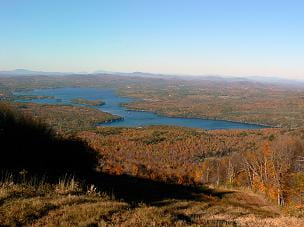
Non-point source pollution to Lake Sunapee – Lake Sunapee, the sixth largest lake in New Hampshire, is located in a rapidly developing watershed, and the lake and its watershed are the primary focus of an active non-profit education and outreach organization, the 100 year-old Lake Sunapee Protective Association (LSPA). In partnership with the LSPA, several collaborators and I are using field sampling to quantify how watershed characteristics interact with precipitation to determine the type, rate, and magnitude of sediment and phosphorus (P) inputs to Lake Sunapee. We are working to determine where and when best management practices need to be applied to minimize P loading to Lake Sunapee.
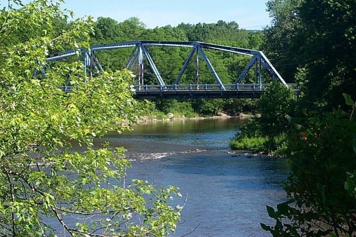
SUNY New Paltz Campus, Saw Mill Brook, and Wallkill River water quality – Regional climate change models indicate an increase in temperature and increased probability of severe precipitation events in the Hudson Valley (NECIA 2006). Indeed, observations recorded over the last 116 years by the Mohonk Preserve in New Paltz indicate that such an increase in average annual rainfall is already underway – up 7.8 inches over the century – putting increased pressure on systems designed to manage storm water. The Saw Mill Brook starts in the neighborhood east of campus, flows through SUNY New Paltz, the Village and Town of New Paltz before joining with the Wallkill River near the Water Street Market on Plains Road. On the SUNY New Paltz campus, the stream forms the “Gunks,” a chain of ponds before continuing flow back into residential New Paltz neighborhoods. The Saw Mill Brook’s watershed is approximately 1,120 acres in size, and this relatively small scale makes it an appropriate size for monitoring and management. This project is a collaboration across several departments at SUNY New Paltz and the Center for Research, Regional Education & Outreach, seeks to improve water quality, provide environmental education opportunities, measurably increase resilience to climate change, reduce the severity and impacts of floods, and begin the long-range transition to sustainable stormwater and watershed management by laying a foundation for relying on green infrastructure technologies in public works projects. We have established a buoy in the large campus pond and the 2013 data is displayed here.